
Hello everyone!
The eye of Hurricane Dorian is located about 15 miles south of North Carolina’s Outer Banks this morning and is moving northeast at a brisk pace. The storm will pass just outside the 40N 70W ‘benchmark’ we use to forecast winter storms around 2 AM tonight. Just like a winter storm, this track means we’ll be at the edges of the storm, close enough to know it’s there but far enough for it not to be all that big of a deal.
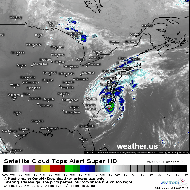
Ahead of the storm, we’ll see increasing high clouds today. The clouds you’ll see are actually streaming north directly from the hurricane’s center, as shown by the satellite loop above. It’s pretty cool to think that the moisture producing those clouds came from the warm waters of the tropical Atlantic before rising through the storm’s powerful updrafts, getting pushed out of the top of the cyclone, and finally carried by the jet stream far to the north and east.
Back to our local weather, while clouds will be increasing today ahead of Dorian, any rain from the storm should hold off until near sunset (Southern NH) or after (everyone else). The best chance for rain overnight tonight will be along the coastal plain, where a few heavier showers are possible tomorrow morning before rapid clearing tomorrow midday/afternoon.
High temps will generally fall in the mid to upper 60’s today with slightly cooler temps in the north, and a few spots near Waterville perhaps touching 70.
-Jack
