Drier Weather Arrives Today

Hello everyone!

Today will feature the return of drier weather as yesterday’s cold front slowly sags offshore and winds switch around to the north/northwest. As a result, any showers lingering along the coastline will be departing over the next hour or two, and the region will remain dry for the rest of the day.

The front’s thick cloud layer will take more effort to remove from the area today as a wave of low pressure develops along the front to our south. Clearing will take place from north to south today, though I doubt that Southern New Hampshire actually sees much if any sunshine. The farther north you are, the nicer your day will be.

High temps will range from 55 in the mountains to 65 along the coastal plain.

-Jack

Steady Rain Arrives Today

Hello everyone!

Today will feature the arrival of yet another cold front as low pressure tracks well to our north through Quebec. This front will be tapping into some moisture from the deep tropics, which means it will be able to provide a steadier and heavier rainfall event compared to what we’ve seen recently.

Radar imagery shows showers now entering the mountains, with the bulk of the rain still back across New York. It will take a while for the rain to arrive today, and the coast actually may stay mostly dry until this evening. I think the high resolution model guidance has a pretty good handle on when the rain will arrive, so I’ve included a loop below that runs from 10 AM to 10 PM showing the slow SE push of rain throughout the day.

Along with the rain, expect overcast skies today as a result of the cold front. The exception may be some brief periods of sunshine near the NH/MA border this morning. Those brief sunny breaks will help push temps up towards 70 in that part of the area, while most of the rest of us will top out within a few degrees of 60. Cooler temps, between 50 and 55, are expected in the mountains.

Skies will clear tomorrow as the front shifts offshore.

-Jack

Clouds Increase Again Today

Hello everyone!

This time of year, we expect to see frequently changing weather as frontal systems pass through with a higher frequency than either summer or winter. That’s exactly what we’ll be seeing today as yet another cold front begins its approach from the west.

Ahead of the front, we’ll see increases in both temperatures and cloud cover, as well as the chance for some showers later in the day. Those showers will likely enter the mountains during the mid/late afternoon hours (3-5 PM) before weakening as they move east. Steadier and heavier rain will arrive from the southwest tomorrow.

High temps today will range from 55 in the north to 65 in the south.

-Jack

Picture-Perfect Fall Weather Today

Hello everyone!

Today will feature absolutely phenomenal weather for this time of year as strong Canadian high pressure crests over the region. Expect morning fog in the CT River valley and adjacent parts of NNH to burn off over the next couple hours. Those areas will join the rest of the region in enjoying full sun for the remainder of the day. High temps will range from 50 in the north to 60 in the south with light winds region-wide.

If today isn’t a perfect day to head outside to see the foliage, I don’t know what is. Enjoy!

Tomorrow we’ll see more clouds and some showers as our next cold front approaches from the west.

-Jack

Cooler Air Continues To Arrive Today

Hello everyone!

Cooler air will continue to pour into the region on northwest winds today as an area of low pressure races off to the east. This low won’t be intense enough to bring very strong winds, but you’ll still notice the breeze as you head out and about. Temps and dew points will continue to fall as the new airmass moves in, with highs ranging from the low 40’s in the north to the upper 50’s along the coastal plain. Cloud cover will slowly diminish as that low moves farther offshore, with the best chance for a few hours of sunshine being along the coastal plain where downsloping will help dry and warm the lower levels of the atmosphere.

-Jack

Much Cooler Today, Clouds Increase Again

Hello everyone!

Today will feature much cooler temps and cloudier skies as a wave of low pressure moves along yesterday’s cold front which is now located to our south. Skies are clear across much of the area as I write this around 6:30 AM, but clouds are quickly moving in from the west ahead of that low. Most folks should catch a nice glimpse of sunrise this morning but overcast conditions will develop shortly thereafter. The precipitation associated with this system will arrive in the CT River valley around 7-8 this evening before spreading east tonight. While most of us will be warm enough to see rain, elevations above 3,000 feet are likely to pick up an inch or two of snow during the early morning hours tomorrow. Tis the season!

High temps today will range from 45 in the north to 55 in the south.

-Jack

Cooler Air Arrives Today

Hello everyone!

Today will feature the arrival of cooler air as a cold front crosses the region and Canadian high pressure begins building in from the north. The front is currently working through the mountains and northeastern foothills this morning (Greenville is reporting a 20 mph NW wind behind the front while Bangor is WSW at 5 mph ahead of the front), and will make its way south during the morning. By midday, the front will have passed through the entire region and we’ll all be enjoying cool northwesterly flow.

Precipitation along the front will be moving in from the west as a weak disturbance aloft rides along the boundary. By the time that disturbance gets to our longitude, the front will have moved far enough south that the mountains are likely to stay mostly dry. Southern and central areas can expect a round of showers between roughly 8AM and 12 PM. Another wave will pass along the front later in the afternoon, and will bring another round of rain to southern NH.

Temps today will be falling across the area, so whatever you’re feeling outside now will be your high for the day. By 2 PM, the mountains will be sitting in the upper 40’s, the foothills and northeastern parts of the area in the low to mid 50’s, and far SW ME/S NH in the low to mid 60’s. By 8 PM, temps will have fallen another 5 degrees or so across the area before bottoming out in the low 30’s north and mid to upper 40’s south overnight.

For your enjoyment, here’s a loop of today’s dew point forecast showing the dry air sweeping in from north to south. What a delightful sight!

-Jack

The Last Summer Airmass Of The Season Arrives Today

Hello everyone!

The last truly summer-like airmass of the season will be arriving behind a warm front today meaning that temps and humidity will be back on the increase. The warm front will have some trouble making it all the way through the region today, which means that there will be a fairly wide range between conditions occurring in the northeastern and southwestern parts of the area.

For the southwest, particularly SW NH, it’s summer’s last hurrah today with temps climbing into the mid to upper 70’s and dew points soaring into the upper 60’s. Some showers and a couple rumbles of thunder are possible as the front moves through midday, but otherwise most of the day should be dry.

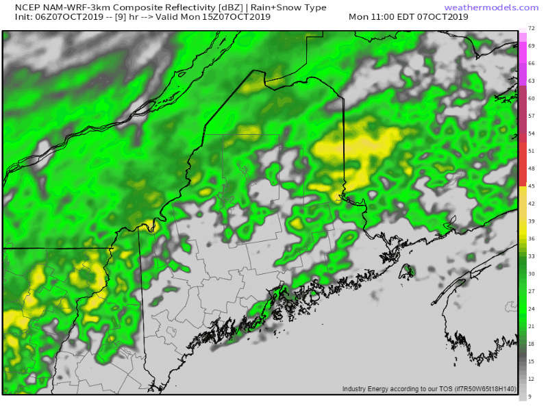
For the middle of the area, today will be on the cooler but more humid side. Showers currently ongoing this morning will taper off in the next 2-3 hours before mostly dry weather returns for this afternoon. Highs will generally fall in the mid to upper 60’s.

For the northeast, we’ll retain the feeling of fall until much later this evening. High temps will be on the cooler side, in the mid 50’s to low 60’s, and dew points won’t cross the 60 degree “uncomfortable” threshold until after 10 PM. Showers currently ongoing this morning will take a while to taper off this morning, and will be replaced by another round of showers later this afternoon into this evening.

Everyone goes back to the dry weather tomorrow, with cooler temps following for the end of the week. If you’re up in the mountains above around 2,500 feet or so, Friday will likely bring your first snowflakes. Tis the season!

-Jack