Hello everyone!
While May is now just a few days away, the atmosphere appears to be joining many of us in reminiscing about more “normal” days earlier this winter. With that in mind, we’ll be doing our best ‘early March’ impression over the next few days as a coastal storm develops and redevelops several times over the Mid Atlantic and the waters off Cape Cod.
The first round of redevelopment is now underway off the Delmarva. As that low moves in our direction, expect any morning breaks of sun to quickly fade behind a thickening overcast over the next hour or two. Precipitation is already knocking on SW NH’s doorstep according to radar imagery but so far none of it appears to be making it to the ground. Rain will begin in SW NH around 1-2 PM before advancing northeast into Maine around 3-4 PM. Before the storm arrives, temps will jump into the mid 40s in SW NH, upper 40s in the mountains and along the coast, and low to mid 50s for interior parts of Maine. Initially, as precipitation moves in during peak heating hours, the precipitation type will be rain. However, as we approach sundown, a change to snow will begin in the higher elevations of NH and western ME.

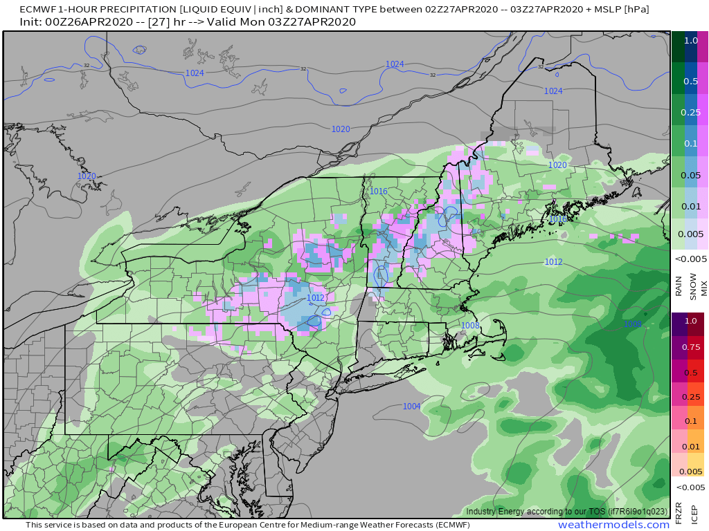
This model forecast snapshot valid at 11 PM today shows snow falling in the mountains with a mix in the foothills and rain along the coast. Temperatures aloft are supportive of snow all the way to the coast (except perhaps for the Midcoast peninsulas) so precipitation type will be determined entirely by surface temperatures (generally lingering in the mid 30s). With that in mind, expect precipitation type to be determined largely by precipitation rate. When heavier bands arrive, snow will fall all the way to the coast. During lulls, much of the coastal plain will flip back to rain while light snow continues in the foothills and mountains.

This pattern will generally hold through tomorrow as the storm reaches its peak (though still quite modest) intensity just east of Chatham MA. We’ll be in the perfect spot for heavy bands just NW of the low which means that snow is likely to advance closer to the coast. On the other hand, the strong late-April sun will be working to warm temps near the surface. Even if temps rise by just a few degrees, that would be enough to knock precip types from snow to rain. Either way, snow will have a hard time accumulating during the daytime hours tomorrow. We’ll have a better sense of what the storm will do tomorrow once we see the whites of its eyes.
Believe it or not, this system will continue to bring rain and snow to the area on Tuesday as it slowly meanders east.
-Jack
