
Hello everyone!
We’re about 8-12 hours away from the onset of snow here in the area which means it’s time for one last crack at this forecast before we sit back and see what happens.
On a large-scale, the forecast outlined this time yesterday is more or less on track.
The swirl we were tracking across TX/OK yesterday is now moving northeast through TN/KY and moisture is streaming north out ahead of it. Meanwhile, our Arctic airmass is well-entrenched and saves us the hassle of worrying about a rain/snow line. The problem is that said airmass might be a little too entrenched and it’s as dry as it is cold. Therefore, snow is going to struggle to make it to the ground over most of the area tonight and perhaps for much of tomorrow too.

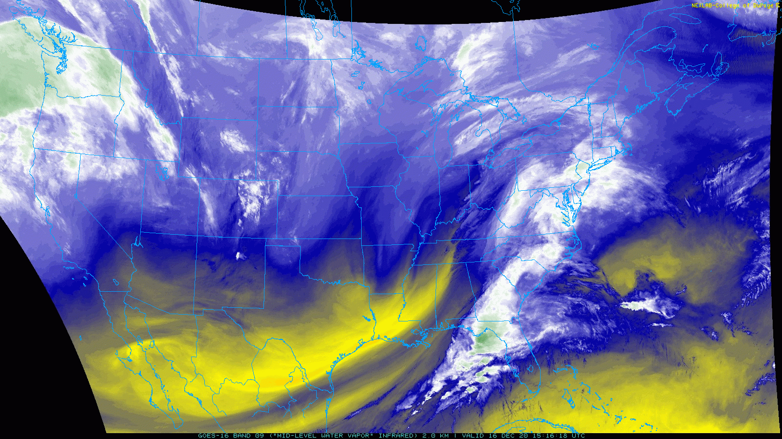
Here’s a look at regional radar imagery and surface precipitation observations as of 4 PM. Snow is falling west and south of NYC with some rain/ice mixing in east of I-95 south of Philly. Farther north, low-level dry air is preventing snow aloft from making it to the ground.
The big question is just how stubborn that dry air is going to be over the next 24 hours.
The trend in high-resolution weather model guidance over the past day or so has been towards that dry air being more stubborn than originally forecast. This is supported by surface observations today showing the area of high pressure over Quebec a bit stronger than expected. It also fits a bit better with what’s historically expected from a setup like this. Remember in yesterday’s forecast we talked a bit about how the fact that this storm was weakening and not strengthening as it approached the region gave some pause about the higher-end snow forecasts. Sure enough, it appears that skepticism was warranted.
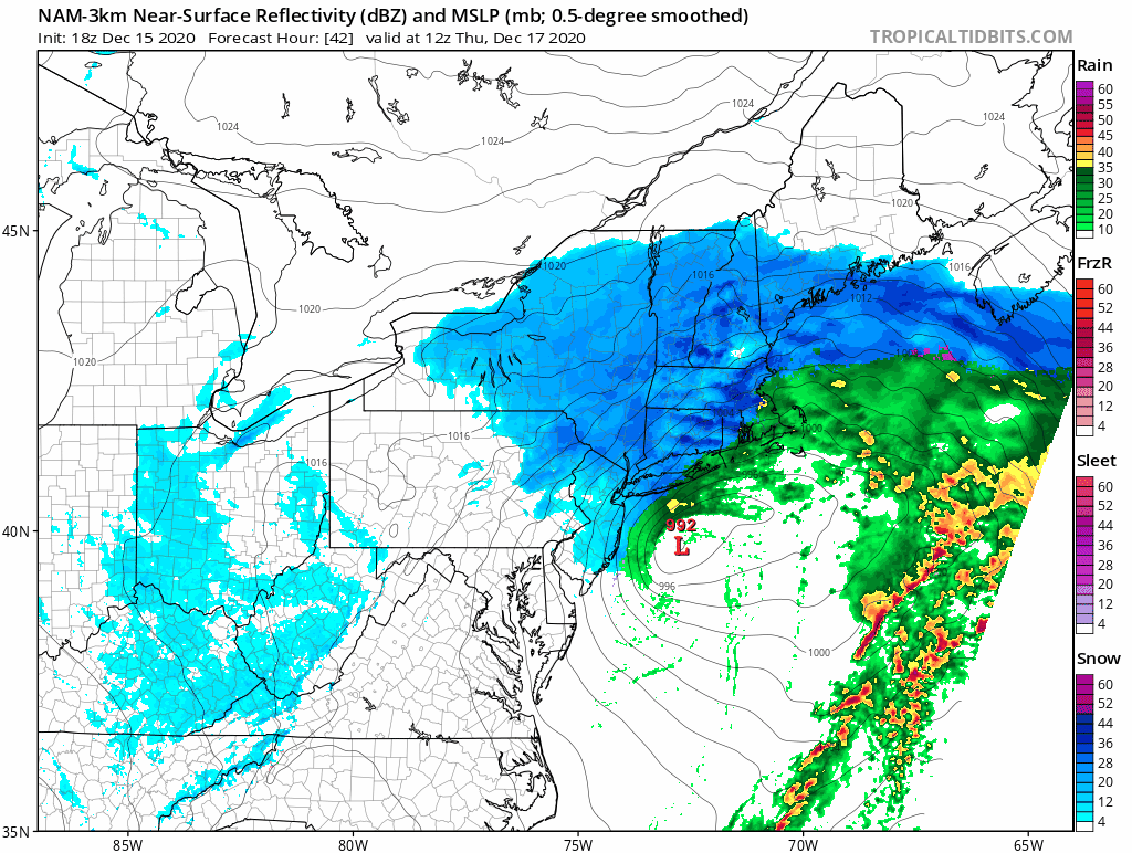
With all this in mind, here’s one last crack at a snowfall accumulation map for the area.

I’m still quite confident that the heavier bands will be able to work their way into southern NH and York County ME. That’s where the jackpot will be for this storm and over a foot is likely here. The mountains seem likely to miss out almost entirely which is a real bummer for those of us hoping to ski some fluffy snow this weekend. The forecast challenge is really figuring out points in between. I suspect the real gradient will be a lot sharper than it appears on the map here. You might only have to drive 10-20 miles to get from dustings to nearly a foot, but beyond the idea that this is most likely to happen somewhere between Fryeburg-Lewiston-Camden, there’s no way of knowing exactly which towns will fall on which side of that gradient.
Snow is still on track to start in SW NH later this evening before struggling northeast into SW Maine tomorrow morning. Snow will reach its maximum northern extent sometime midday tomorrow before departing to the east tomorrow afternoon.
Whatever snow is able to fall will not hesitate to become airborne once again as northeasterly breezes pick up and the frozen ground prevents much if any melting.
-Jack
