
Hello everyone!
Quick evening update here to outline tomorrow’s storm in a bit more detail before it gets underway.
The bottom line is that a mid-grade winter storm is headed towards the region tonight and will arrive with a burst of moderate to possibly heavy snow early tomorrow morning. Snow will mix with some sleet and rain in southern/coastal areas later tomorrow morning before a final burst of snow throughout most of the region early tomorrow afternoon. If you’re curious about more of the details, read on!
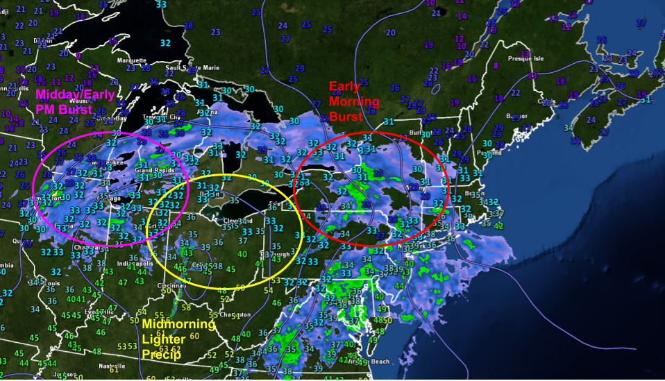
Radar imagery this evening shows the elongated structure of our incoming storm. The system is moving in from the west-southwest, so we can draw a line in that direction and get a pretty good sense of what the forecast might entail for the next 24 hours. We’ll start off with a solid burst of snow in the early morning hours before the lull in precip currently over Ohio arrives. The storm will then wrap up with the burst of heavier precip currently near Chicago.
The little numbers on the map above are current (7 PM EDT) temperatures. Note that most of our area is near or, in the case of Manchester NH, a little above freezing. This means that we’ll have to worry a bit about precipitation types.
The forecast map below shows a bunch of information useful for thinking about the storm. We’ll start with the shadings which depict temperature (see the scale at the bottom of the image) and precipitation type (blue = snow, orange = sleet, pink = ice, green = rain).

The mountains will hold onto enough cold air to keep this one all snow. Far southeastern NH is already above freezing and will remain that way through most of the event, so I’m expecting mostly rain there (except for a quick burst of early morning snow). It’s the in-between spots that will be trouble. Right now, it looks like warm air aloft will make it as far north as the White Mountains in NH and about Lewiston/Augusta in Maine. That means that snow will change over to sleet and/or ice (sleet is more likely in Maine and central NH, ice is more likely in southwestern NH).
Right along the immediate coast east of I-95/I-295 and south of Route 1, surface temps may warm up just enough for some mixing with plain rain.
Around 8-9 AM or so, we’ll start to see the lull build in as the original storm fizzles out and a new one takes its place east of Cape Ann.

The lull will be most pronounced in southern areas where a mix of sleet/rain will give way to drizzle/freezing drizzle. Moderate snow should continue in the mountains as cold air begins to slowly drain south on the back side of the coastal low.
This storm’s final act will come as that coastal low starts developing in the Gulf of Maine, bringing one last burst of moderate/heavy snow to most of the area (except perhaps the coast south of Portland) before precip wraps up during the mid/late afternoon.
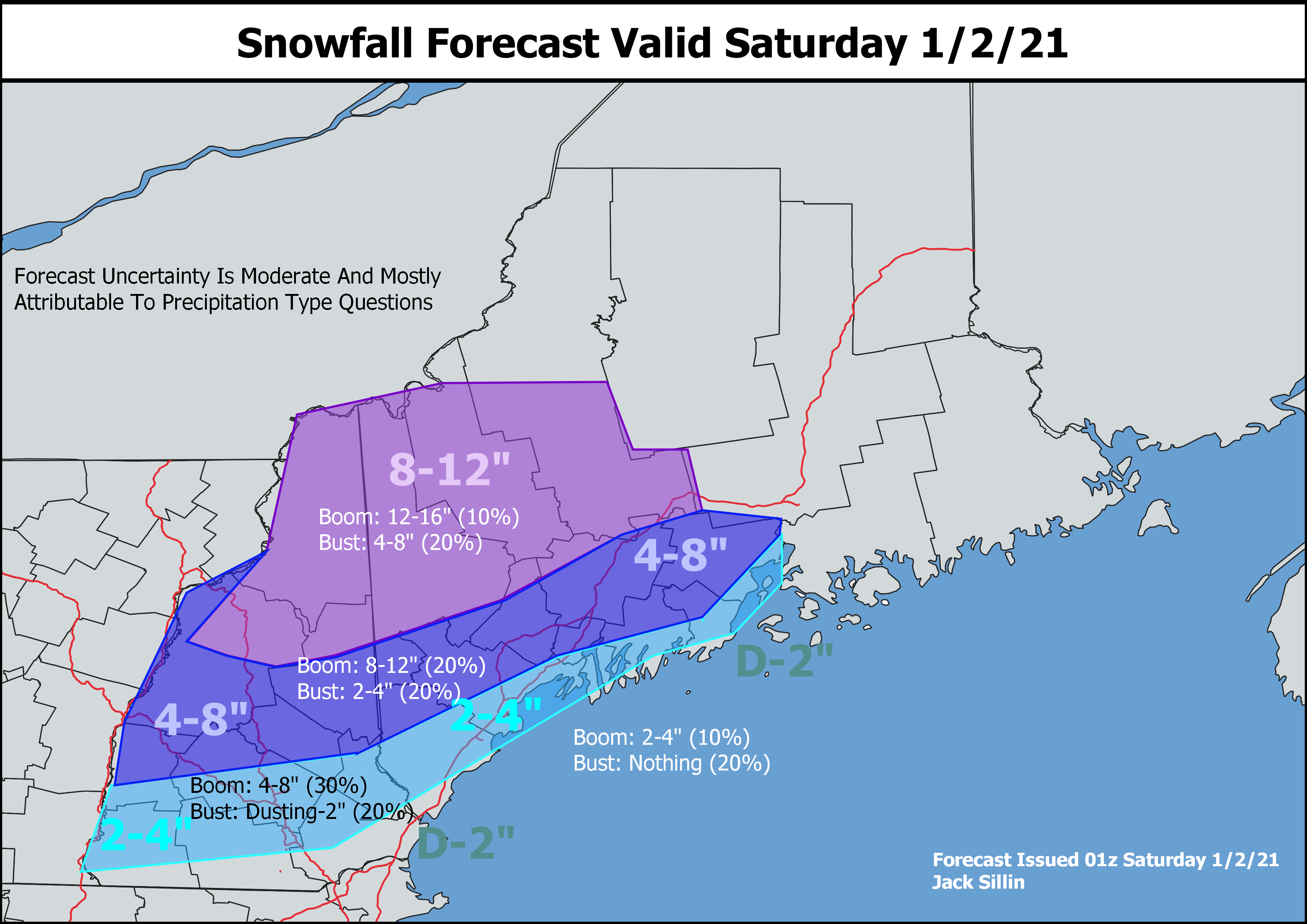
Here’s a look at how much snow I think should fall across the area tomorrow. The jackpot will be up in the mountains where 8-12″ of pure snow should pile up. Amounts drop off as you head closer to the coastline and farther south where rain and sleet/ice will mix in.
Make sure as you’re cleaning up tomorrow afternoon to leave plenty of room for more snow. More is likely to arrive as soon as Sunday night, and there could be quite a bit for some!
-Jack

👍👍❄