
Hello everyone!
The storm I talked a bit about yesterday is on our doorstep this morning.
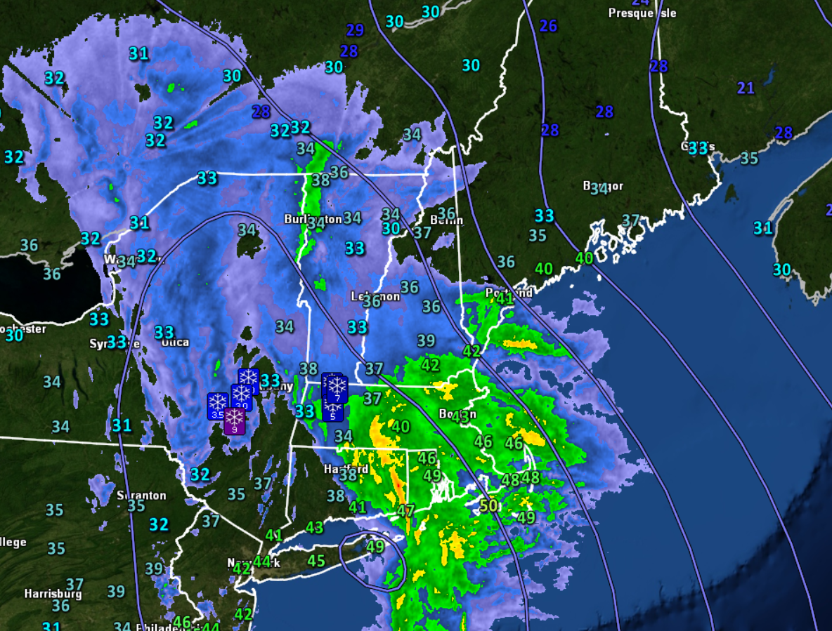
Surface observations across the area show moderate to heavy rain advancing north from the Boston area into Maine and New Hampshire. Temps across the area are just a bit too warm for snow outside the higher terrain. As precip increases in coverage and intensity this morning, temps will drop a bit especially up north, but snow is still likely to be mostly a higher elevation affair today. Also worth noting is that several thunderstorms have been observed down in Boston this morning. Some rumbles definitely aren’t out of the question as these cells move into our area over the next few hours.
Rain and snow will continue to move in this morning and will become heavy by the time lunch approaches.

The peak of the storm will be in the early to mid afternoon as the storm center moves from Cape Cod towards Portland. During this time, rain will be heaviest along the coast, snow will fall at rates of 1-3″ per hour up above 2,500 feet or so, thunder will be possible especially south of Portland, and winds will peak along the coast.
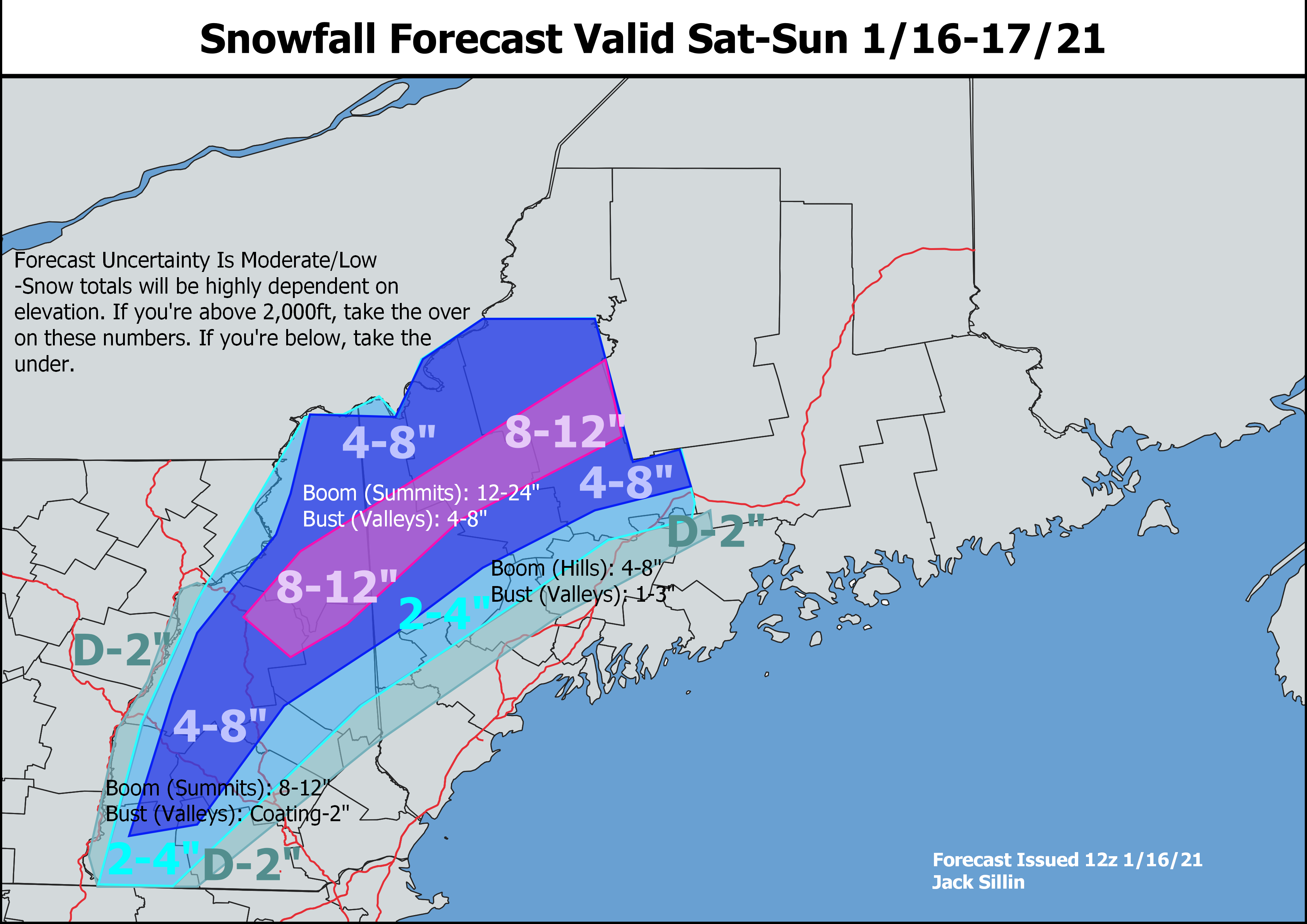
Here’s a quick look at expected snowfall accumulations with the major caveat that totals will be heavily dependent on elevation. If you’re above 2,000 feet or so, take the over on these numbers. If you’re in the valleys, take the under. The jackpot still looks to be about 18-24″ for the higher summits in the Whites and possibly the top of Saddleback/Sugarloaf too. This is going to be heavy wet snow, but that’s exactly what we want right now to set a solid base for future powder skiing.
Wind gusts along the coast are likely to peak around 35-45 mph with a few 50-55 mph gusts possible northeast of Portland. This is definitely enough to produce some outage concerns, especially in the spots that tend to go dark first.
Rain and snow will taper off this evening except in the mountains where upslope snows will continue through the night and into tomorrow with several inches of additional accumulation.
High temps today will range from the mid 30s up north to the mid 40s in the south.
-Jack

Hey Jack, my prayers were answered and were actually in the heavy snow band (very heavy!: http://hartfordmewx.info/images/imagesouth.jpg) this morning and I think you may have to move those snow amounts just a hair further SE. You have us in the 2-4 but at the rate it’s presently falling I could see us getting 4-8 or even 8-12 depending on how much longer it lasts.