
Hello everyone!
Today will feature another light to moderate snow event as another weak wave of low pressure slides to our south.

Water vapor satellite imagery shows air mostly moving from west to east across the Great Lakes, Midwest, and Northeast this morning. This is a key reason we won’t be dealing with a blockbuster storm today. To get a big storm, we need moisture to be transported from south to north, and that’s not happening in a big way today. That said, this little system will do its best with the moisture it’s got and that should produce some decent snowfall totals especially over southern parts of the area.
Flurries are already falling across southern parts of the area this morning, but the main round of precipitation will arrive from west to east during the mid/late morning hours.
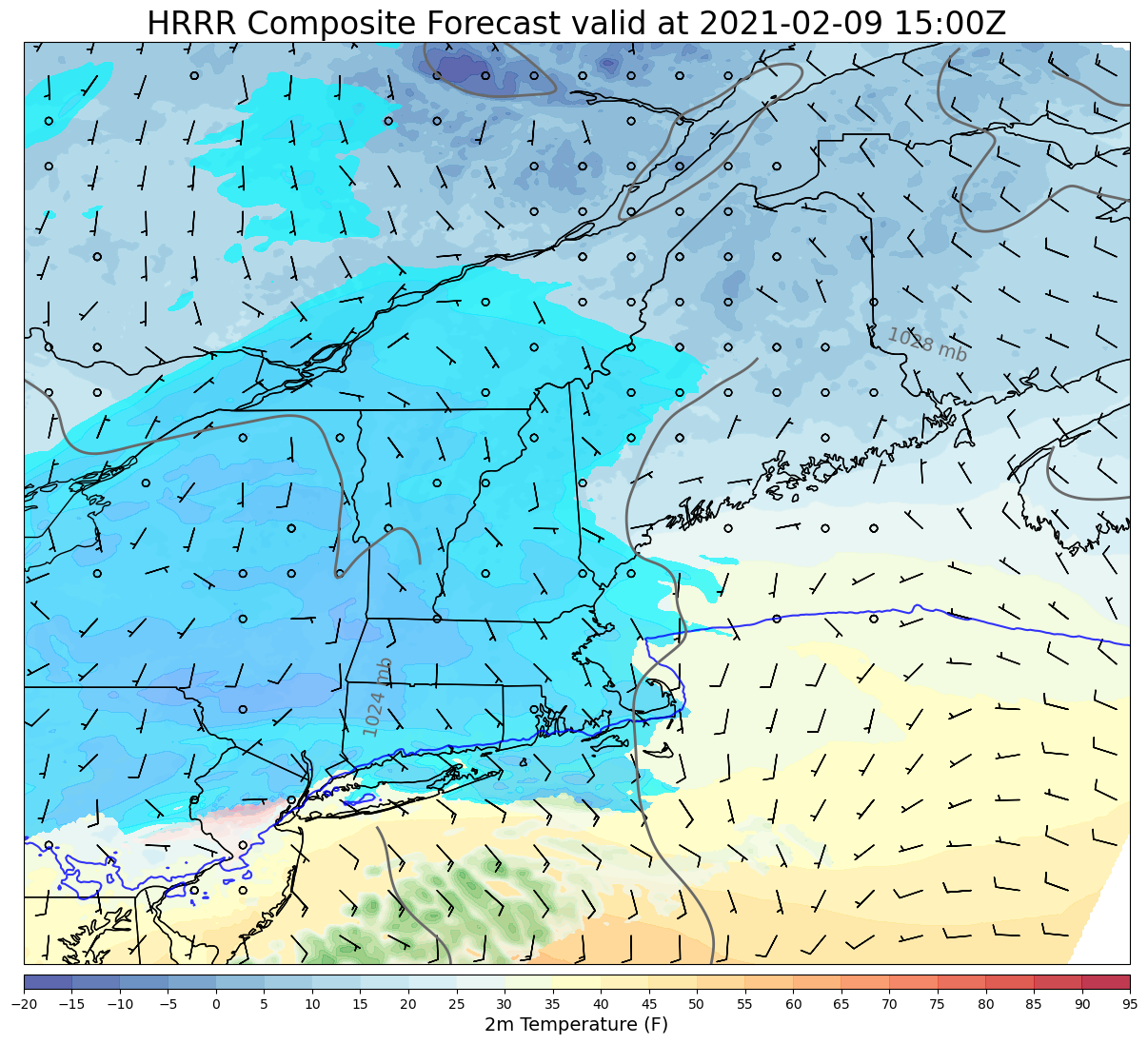
This forecast map valid at 10 AM highlights the steadier snow moving into New Hampshire around this time. Note that the freezing line (dark blue line) is well south of the region so we won’t have to worry about mixing with this one.
In fact, the cold airmass in place will help support high snow to liquid ratios today.
This is a little bit of a technical detour, but I like to give a peek under the hood of the weather forecast from time to time so here’s what I look for when evaluating the potential for high-ratio snow.
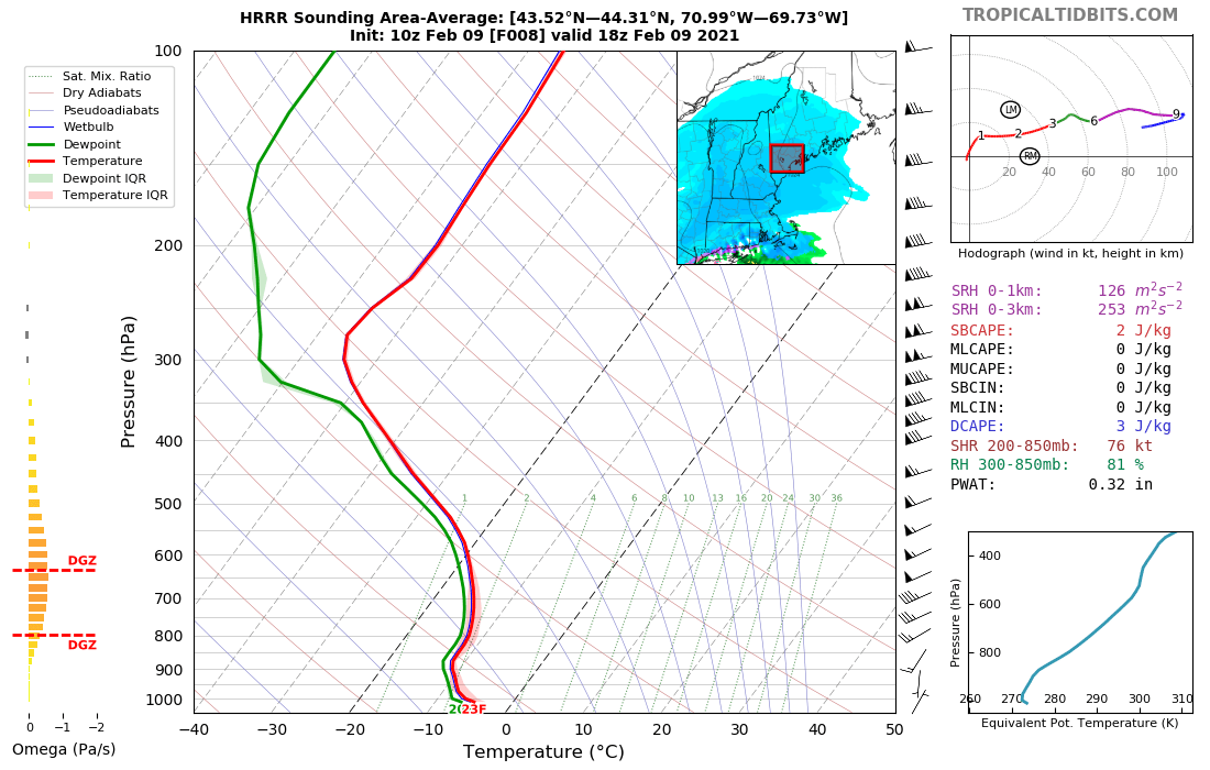
The six-sided dendrites we all imagine when we think of snowflakes can only form under certain atmospheric conditions. They need temperatures between -12 and -18C, high relative humidity, and upward motion. The more space in the atmosphere that these conditions are satisfied, the more dendrites we’ll get and the fluffier the snow will be. On the chart above, which represents the average forecast conditions over southwestern Maine, we see that the layer of -12 to -18C temperatures (Dendritic Growth Zone = DGZ) spans several thousand feet (800mb = 6000 ft, 625mb = 13000ft). In that layer, the dew point is nearly equal to the temperature (green and red lines are close), and we have about 1 Pa/s of upward motion (little orange bars off to the left where the DGZ is highlighted). This is a strong signal for high ratio snow!
Most model guidance only gives us about 0.1″ of liquid equivalent precipitation in the foothills and 0.2-0.3″ along the coast and in southern NH. But with such good snow growth dynamics, we should be able to stretch our snow to liquid ratios out to around 15 or 20:1. That means for every 0.1″ of liquid, you can expect about 1.5-2″ of snow (usually, that number is closer to 1 or 1.2″).
If you work out that math, you’ll see where I’m going in terms of snowfall amounts today.
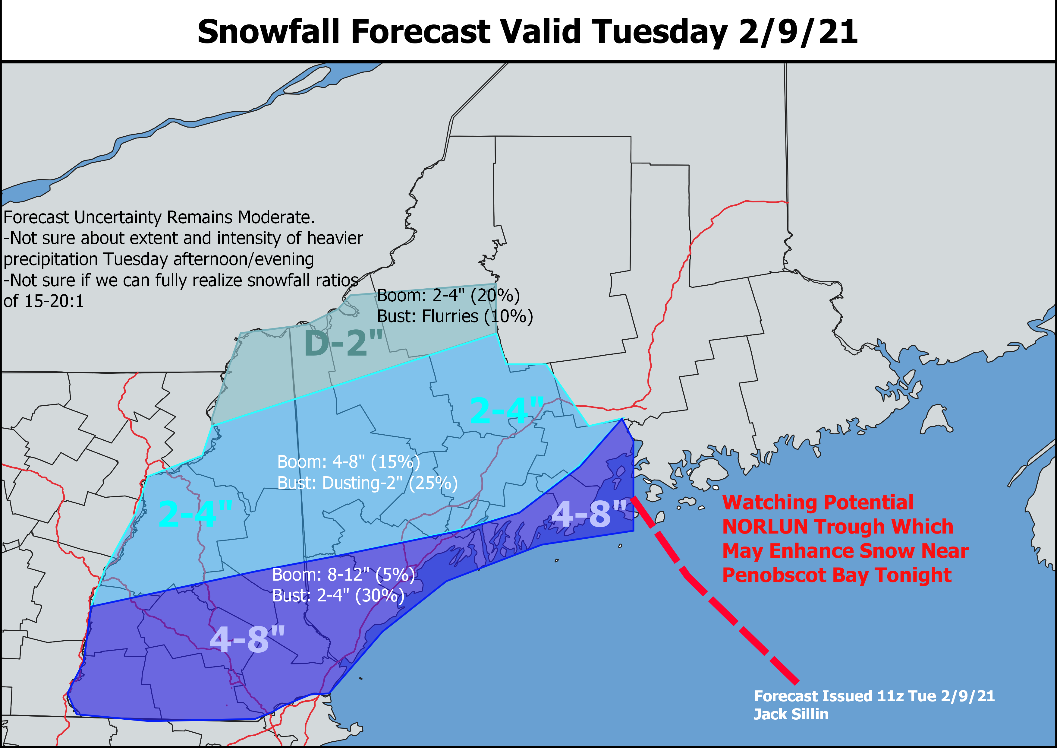
Just like the last storm, I don’t think we’ll push towards the upper end of the 4-8″ zone, but I am expecting quite a few 4 and 5″ reports with a few 6-7″ jackpot winners probably between Nashua and Portsmouth NH. One wildcard in the forecast is the potential for an inverted NORLUN trough to give snow a boost near Penobscot Bay. Model guidance is notoriously challenged by these features, but if such a trough can push onshore, I’d expect to see a few spots between Boothbay and Belfast join the 6″+ club.
Farther north, snow will also be fluffy but there just won’t be as much moisture to go around. I think a general 2-4″ will be the rule for the foothills and mountains with locally higher amounts at elevation and lower amounts found up towards the Canadian border.
High temps today will be on the cooler side, ranging from the low 20s up north to around 30 in southern NH.
-Jack
