Hello everyone!
After a couple potential storm systems ended up fizzling out or sliding too far south to bring impacts to Maine and New Hampshire, our next round of widespread wintry precipitation is now headed in our direction.

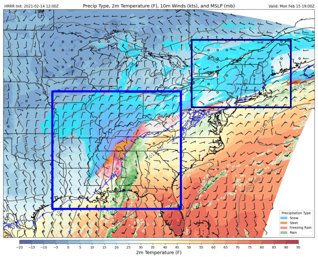
You can find our system easily on water vapor satellite imagery this afternoon. It’s the big swirl over New Mexico. Before it arrives in our area, it will bring a once-in-a-generation winter storm to Texas and parts of the lower Mississippi Valley. Several inches of snow could fall all the way down to the Gulf Coast as wind chills drop near zero in places like Houston and New Orleans. Parts of Mississippi could pick up an inch of ice which was enough to pretty much shut our area down back in December of 2008. Not that any of this is especially relevant to our forecast, but it’s interesting enough to warrant a quick mention!
While causing some serious problems to our south, the system will send an opening shot of snow at the region tomorrow afternoon.

This forecast map valid 2 PM tomorrow shows that first round of light snow moving into New England well ahead of the main system over Tennessee. Snow will begin across the area around noon in NH and in the early afternoon over Maine. This first round of snow will drop a dusting to perhaps as much as an inch over the course of the afternoon before tapering off to flurries around sunset.

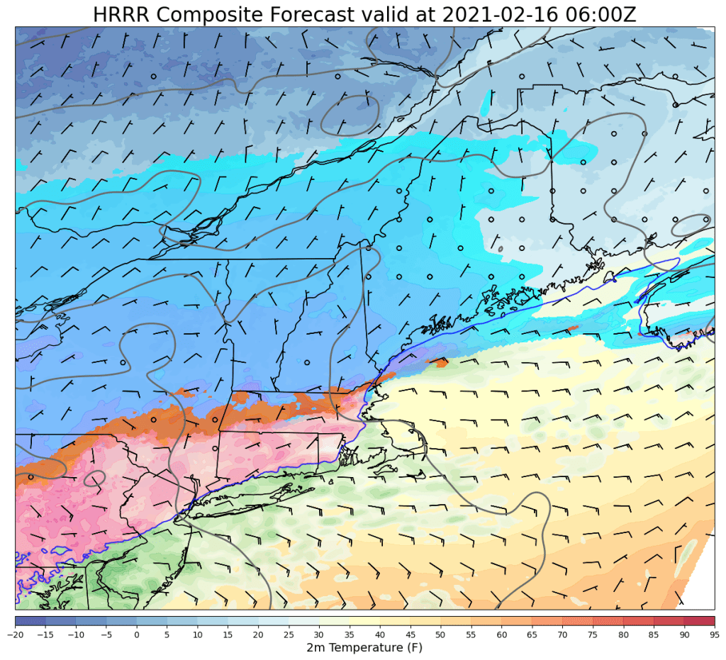
The main round of precipitation will arrive from southwest to northeast around midnight Tuesday. Initially, everyone will see precipitation falling as snow, but warm air will be quick to surge north about 7,000-10,000 feet above the ground.

By 7 AM, moderate snow will be falling across much of the region with sleet mixing in across southern NH and parts of Maine south of Portland. This is when the really tricky part of the forecast begins, because moderate/heavy precipitation will be falling and we need to figure out exactly what temperatures will be throughout that freezing layer to know who will be piling up an inch of snow per hour, who will be hearing the incessant pinging of sleet, and who will be watching their trees sag under the weight of ice.

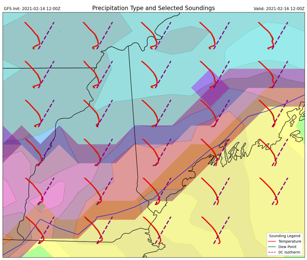
The best tool for analyzing the temperature of the atmosphere at different heights is shown here with the little curvy red lines (temperature). Where the curvy red line is left of the nearest purple dashed line, temperatures are below freezing. Above freezing temps are located to the right of the purple dashed line. At most spots across the area tomorrow morning, the curvy red line gets very close to the purple dashed line a little ways above the ground. In southern areas, the red line makes a noticeable detour to the right of the purple line which indicates a layer of above-freezing temperatures in which snowflakes will melt. Closer to the ground though, the red line regains its distance from the purple line which means that temperatures at the surface will support frozen precipitation (except maybe for a couple spots at the beach in southern NH where plain rain is possible).

Our nose of above-freezing air aloft should make it to the mountains right around the end of the storm early afternoon, so a few pings of sleet might be heard but otherwise, snow will rule the day.
With a bit more understanding about what’s likely to happen above our heads, we can now move onto the part that everyone cares about most: what will end up on our driveways.

Here’s my best guess as to how much “frozen stuff” will pile up across the area on Tuesday. Up in the mountains, this will essentially all be snow with 4-8″ expected. That said, the warm layer responsible for sleet and ice in the south will impede efficient snowflake production up north, so this won’t be super fluffy snow.
Farther south, totals will range from 1-4″, but the same amount of liquid will be backed into that thinner layer. Sleet and ice will increase the snow’s density so while not as much is expected, it will still be slick and heavy to shovel.
Freezing rain will most likely mix in for a time across southern New Hampshire, but at the moment it looks like the cold air near the surface will be cold and deep enough to refreeze most droplets before they hit the ground. So while an extremely slippery glaze to tenth of an inch is possible, thankfully we should avoid the 0.3″ and up amounts that start to cause problems with the power grid.
Snow, sleet, and freezing rain will taper off from west to east during the early to mid afternoon hours on Tuesday.
-Jack
