All posts by Jack Sillin

I’m a third-year atmospheric science student at Cornell University who has been blogging about the weather since 2011. While I’m not officially a meteorologist, I have accumulated a bit of experience forecasting both local weather (in western Maine and New Hampshire) as well as national/international weather during my time writing for weather.us and weathermodels.com. I also have experience programming in Python, teaching concepts in weather forecasting, and communicating forecast information to general audiences.

Nice day today, weekend storm looks farther east

Hello everyone!

Today will feature mostly sunny skies across the region with the mountains seeing a few more clouds. Temps today will rise into the 40’s in the mountains and 50’s elsewhere. All and all, it will be a pretty quiet day.

today 10-30

As for our weekend storm threat, it’s looking more and more likely that we see just a glancing blow as the storm moves OTS. All 0z models, operational and ensemble means take the storm east of the 40N 70W benchmark which is the ideal location for a New England heavy precip event. Snow will still fall in the favored upslope areas as well as Midcoast Maine. Cape Cod and SE MA are at risk for some rain showers as well.

-Jack

Cold front brings showers today

Hello everyone!

Today will feature mostly cloudy skies (although some sunny breaks are possible this morning) and the chance for some showers. The best chance for showers arrives in the Mountains this morning then slowly transitions S and W eventually reaching the coast by evening. These showers are in association with a cold front so today will be very mild compared to past days with highs in the 60’s for all.

today 10-29

WEEKEND STORM UPDATE

No significant changes happened with the models overnight, the GFS trended slightly farther west towards a more Euro-like solution although it still has rain/snow for eastern areas only (as opposed to the Euro which gives everyone rain/snow). Right now, I am leaning more towards a Euro like solution because of the Euro’s track record, support from all the teleconnections, and a favorable upper air pattern with a trough in the West (which supports another trough in the east) and ridging in the Atlantic. However, despite these factors, there is still far too much disagreement among the models to firm up any forecast. If for some reason, models are in more agreement with the daytime run, I will have another post tonight with more detail. If not, the next update will be tomorrow morning.

-Jack

Calm and a little warmer today

Hello everyone!

Today will feature calm conditions as we sit under a sprawling high pressure system. Expect temps to be a little warmer with highs in the 60’s for southern areas. Maine and Northern New Hampshire still get to enjoy 50’s for the time being. Some showers are moving out of the mountains this morning and the theme of widely scattered showers should continue throughout the day. Nothing widespread or heavy is expected.

Today 10-28

Enjoy the warm temps while they last because they will be gone in a flash. Tomorrow afternoon features the passage of a strong cold front. Expect gusty NW winds behind the front. Thursday appears to be a nice day with temps a little cooler than normal. Friday continues the cool streak but with significantly more clouds out ahead of our next system.

That next system is the one that looks to impact the region Saturday possibly into Sunday. The models are about as split as Congress is right now with the Euro going big and putting a large, developing low in the Gulf of Maine. The GFS has more of a norlun trough setup as it skirts the main low farther east. For now, I would say that some precip is likely. As for how much/when/what type, we’re far from figuring that out.

-Jack

Breezy and cool today

Hello everyone!

Today will feature a classic post-frontal day with gusty NW winds and upslope clouds/showers. In some of the higher elevations, these showers could fall as snow. Highs today will range from the 40’s in the mountains to 60’s in CT. Downsloping should keep the coast mainly clear regarding cloud cover today.

Today 10-27

Regarding the rest of the week, expect another calm and cool day Tuesday, more clouds Wednesday, gusty winds and more upsloping Thursday, and more clouds and possibly some rain Friday. The upcoming weekend is still very much under debate as far as potential scenarios go. RIght now, I am leaning towards a rain event changing to snow Saturday. Strong winds are also possible with this event. I will do a full breakdown in the coming days.

-Jack

Showers this morning as storm moves out

Hello everyone!

Today will feature a few scattered showers this morning but other than that, the rain is pretty much done. The final day of our four day nor’easter saga will be front-loaded meaning most of the action will be in the morning hours. We might even see the sun late this afternoon! If not, don’t worry, everyone gets to soak up the sunlight tomorrow.

today 10-24

-Jack

Heavy rain and wind this morning

Hello everyone!

Today will feature day three out of the four-day nor’easter saga. Winds  are blowing hard this morning across the area with storm warnings up for the waters. No wind advisories are up for the coast but with the winds out there now, wind advisory or not, prepare for scattered power outages. 1,300 CMP customers are without power across southern Maine.

today 10-23

Here is the radar image from 5:30 this morning. I’ve marked off in the red lines the heaviest band of rain. Inside this band, storms are moving roughly west to east while the whole “train” of storms is slowly lifting north. This feature will affect us in the mid to late morning hours. Expect even higher winds in this band as heavy ran tends to mix strong winds aloft down to the surface. Thunder is a good bet as well then the band rolls through.

Rain will be steadiest and heaviest this morning through early afternoon before tapering to showers. Showers are likely tomorrow morning before moving out all together tomorrow afternoon.

forecast map 10-23

-Jack

PM update on Nor’easter

Hello everyone!

Our nor’easter is getting  going quite nicely over the region tonight. Winds are cranking across the area with gusts approaching 50 mph offshore. Anything above the trees will see very intense winds this evening as the low to our south really gets going.

As of now, the best rainfall is over the mountains but expect the folus to shift back towards the coast this evening. Storm totals of 2-4″ with locally higher amounts along the coast and in the mountains still looks on track.

bands and bands of rain

Expect bands of moderate to heavy rain to continue to rotate onshore this evening into tonight. This trend will continue through tomorrow morning before tapering off tomorrow afternoon. Expect high winds to continue as well slowly backing to the N tonight and evenually the NW by tomorrow afternoon.

-Jack

Wild wet and windy today

Hello everyone!

Today will feature a glum day two of our coastal storm which is still barely developed. Yes, over an inch of rain has already fallen in some areas and the storm hasn’t even formed yet. Today the storm begins its strengthening and as a result, the rain gets heavier and the winds stronger. Expect 20-25mph sustained winds with gusts exceeding 30 mph. As far as temps go, they will have to work HARD to get above 50 today in Portland. I don’t think the mountains make it to 50 and stay in the upper 40’s. Southern New England will make it comfortably into the 50’s.

today 10-22

We’re still on track for a widespread two to four inches but upwards of five inches could fall in one of three “bullseye” areas.bullseye areas

The three areas highlighted in green are where 5+ inches of rain could fall.

The rain is starting out light this morning but expect it to pick up as the day goes on. Tonight will be a wet one for sure as the storm pushes band after band onshore. Tomorrow morning looks similar but rain should taper off tomorrow afternoon.

Expect a repeat of today tomorrow with showers still hanging around on Friday.

-Jack

Day one of nor’easter today

Hello everyone!

Today will feature clouds and showers as day one of our nor’easter gets going. Even now, rain (and snow if you happen to be on Mt. Washington) is falling across the area in scattered shower form. This should how things go this morning, but by afternoon, a coastal front will set up and steady rain will overspread the area with heaviest amounts over southern coastal ME where the front sets up. Winds should remain light today as the cyclone itself is still undeveloped.

today 10-21

As far as the rest of the week goes, expect the heaviest rain to be tomorrow and tomorrow night but keep the umbrellas handy until Friday. Rain stays in the forecast until Thursday, clearing Friday, and back to bright Saturday. Check out the 7 day forecast here.

-Jack

Clouding over today

Hello everyone!

Today will feature the last chance this week for sun as we have a cut-off nor’easter to look forward to. More details on that below. Today however is shaping up to be pretty nice with NW winds slowly subsiding and temps rising into the upper 50’s. Clouds though will be on the increase with fully overcast conditions expected by sundown.

Today 10-20

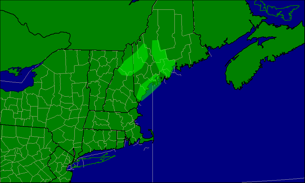
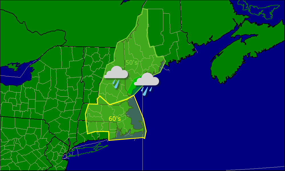
The seven-day forecasts can be found in our new maps section.

——————————————————————————-

As for the Nor’easter slated to hit this week, expect periods of rain starting Tuesday evening and lasting through Thursday evening. Winds will also be gusty at times from the NE.

hpc qpf

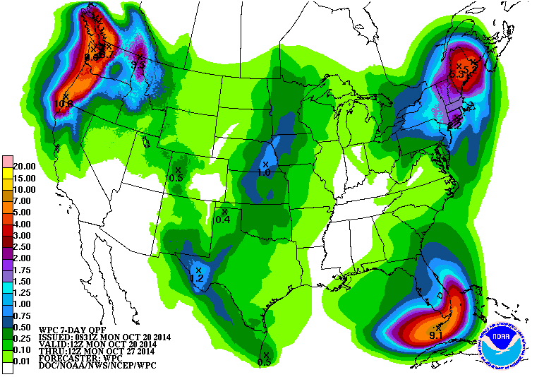
Here is the official HPC QPF forecast for the next seven days (this storm is the only one forecast for the next seven days). I agree with them in that the bullseye should be in the NE corner of our forecast zones however I think 5″ is a little overdone. For now, expect widespread 2-3″ amounts with 4″ possible in NE zones and the favored upslope areas.

Rain moves out Thursday evening/Friday morning and clearing begins Friday evening. Saturday should be bright and clear with breezy conditions possible once again.

With such a long period of onshore winds, coastal flooding is always a big concern. While tides are astronomically high now, they are low by astronomical standards which should prevent significant coastal flooding. With that in mind, some splashover is likely at exposed areas. Also of concern will be beach erosion as wave action will be high during this period. Again, not something to be overly worried about but it is good to keep in mind.

-Jack