I’m a third-year atmospheric science student at Cornell University who has been blogging about the weather since 2011. While I’m not officially a meteorologist, I have accumulated a bit of experience forecasting both local weather (in western Maine and New Hampshire) as well as national/international weather during my time writing for weather.us and weathermodels.com. I also have experience programming in Python, teaching concepts in weather forecasting, and communicating forecast information to general audiences.
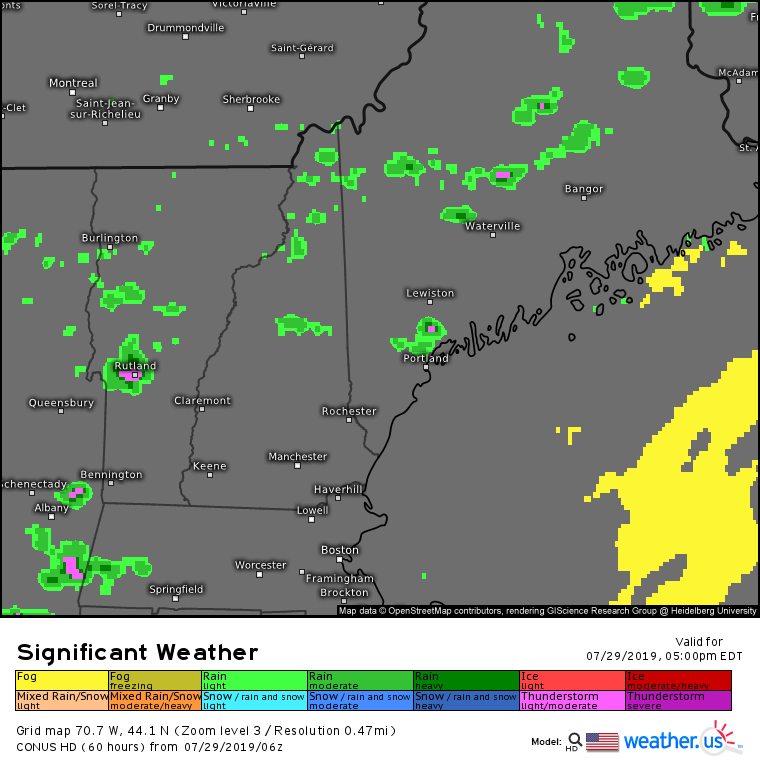
Today will feature cooler temps, a few more clouds, and the chance for showers and thunderstorms. All the aforementioned characteristics of today’s weather can be traced back to a seasonably strong upper level disturbance diving southeast out of Quebec. There are already some showers ongoing this morning; as of 7 AM they are impacting parts of the I-95 corridor north of Augusta as well as parts of the far northern mountains. Expect these showers to expand southeast as the rest of the morning goes on. As with yesterday, the best chance of showers will be in the north. Some will stray into southern areas, but they won’t be quite as numerous.
High temps today look to come in below what we’d expect for this time of year by several degrees. The mountains will stay in the mid to upper 60’s while the coastal plain only makes it a few degrees above 70. Overall humidity will be on the lower side, which will make this a great day to be outside. Just make sure you have a plan to head for cover if a storm pops up nearby. The stronger cells today will feature gusty winds, lightning, and small hail.
I’m back in range of the internet now, which means I can return to the usual programming here on the blog. After thunderstorms along a cold front yesterday and Wednesday, we’ll be left with much nicer weather today. Westerly winds will be bringing in cooler and drier air to the region over the course of the day, so expect morning low clouds and fog to be burning off on the sooner side. Some residual moisture is noted across the region this morning, and as a result we’ll see some instability develop as cool air moves in faster aloft than it does at the surface.
The instability will be released by a weak upper level disturbance moving through the region this afternoon as well as upslope flow over the mountains. Not everyone will see a shower/storm, and in fact most of us should stay dry. For those who do end up under one of the taller clouds this afternoon, a quick burst of rain, some gusty winds, and some small hail can be expected. The best chance of storms will be up in the mountains, and the best chance of staying dry will be along the NH Seacoast.
Highs today will range from 70 in the mountains to a little above 80 in Southern NH. Westerly flow will keep any sea breeze attempts at bay, so the coastal plain will see temps get up into the mid/upper 70’s just like most of the foothills.
You’ll notice this post is coming at an odd hour as it contains info outside the scope/format of the typical morning updates. The order of operations will be a couple quick notes not directly related to the forecast followed by forecast information for the next few days. A quick rundown of the notes can be found below.
Note 1 (Beach to Beacon) Note 2 (Patreon Update) Note 3 (Weather.us Blog) Note 4 (Programming This Week)
The post will end up being on the longer side, but I’ll break it down into smaller sections. Don’t find a section interesting or relevant to you? Just skip to the next one.
Note 1: Beach to Beacon
Since many of you either know me personally, or have spent a while supporting what I do either on the Patreon page or just by reading the blog here, I figured I’d share a few words about a very cool opportunity I got to pursue this summer in case folks might find it interesting.
Over the course of the past couple weeks, I’ve had the great privilege of being involved in the planning process for the TD Beach to Beacon 10K held in Cape Elizabeth. I helped provide weather information to the organizers of the race so that they knew what to expect in terms of race day weather and could plan accordingly. I got to work with some really awesome people who play crucial roles in making sure an event for over 10,000 people goes off smoothly.
Naturally, I learned a lot by participating in such a process. I got to see some of the inner workings behind a major sporting event, and I learned what sort of weather information is really important (and comparatively less important) to the organizers of these large events. Some variables (temperature/humidity/chance of thunder) are very important, while others (sky cover/winds/chance of rain) are much less so.
When I first ran the race three years ago, I never imagined that just a few short years later I would get to be a part, however small (the weather was about as nice as it gets this year), of making it all happen. This is the kind of awesome stuff that happens when a great community lends their steady support to a kid with a passion. So thank you!
They even gave me a cool t-shirt!
Note 2: An Update On Forecaster Jack For The Coming Year
This time last year, I wrote a post explaining that as I was going off to college and free time was dwindling while expenses were increasing, I was going to launch a Patreon platform where readers who were interested could pitch in a few bucks so that I would be able to justify spending time writing forecasts for ME and NH.
The support I got has continued to be really awesome, so I will continue the daily posts for the year going forward. If I’m out of internet range for a few days, I will continue to post multi-day discussions before I leave so that you’re never without weather information.
One change for this year regarding the Patreon page is that all the proceeds will go straight towards educational expenses for the coming year (tuition, textbooks, transport to/from school, etc.). The cost of college is only headed upwards, and while my family and I are still able to afford it, making those ends meet will require a little more effort on my part. With that in mind, if you haven’t yet considered supporting me and this page but would like to, the link can be found here.
Thanks again to all those who chip in a few bucks, I couldn’t do this without you!
Note 3: Weather.us Blog
In case you didn’t know already, I’ve spent the better part of the last two and a half years working for the weather data website weather.us. In addition to other responsibilities, I help maintain their blog which is nationally focused.
Many of the blog posts at blog.weather.us focus on weather that doesn’t impact Maine/New Hampshire so thus is likely of little interest to the audience of this page. However, I also have been building up a collection of generally focused blog posts explaining various weather phenomenon, many of which do impact our area at one time or another. If you’re interested in learning more about the atmosphere and miss some of my longer and more detailed posts, take a look at the weather.us blog. Hopefully you’ll find it at least somewhat helpful!
An example of a schematic used in a blog.weather.us post to explain the sea breeze and how it forms.
Note 4: Programming This Week
I will be headed back out of internet range this week beginning tomorrow and ending on Thursday. As a result, you won’t see daily posts pop up in your feed, but you can refer back to the next few sections of this post which will have. Daily updates will resume on Friday. I anticipate having at least one opportunity early in the week to log onto the computer to type out any forecast updates that become necessary by that time, but plans change and that might not be entirely possible.
Now For The Forecast Half Of This Post
Tomorrow’s Weather
Tomorrow will feature some really nice weather as a cool airmass moves in from Canada. High temps likely will sit around 70 in the northern mountains while the rest of us rise into the upper 70’s to low 80’s. Dew points will drop into the 40’s across most of the area (excluding the very immediate coast) and a northwest breeze will add to the refreshing feel. This is about as good as it gets for August!
Monday’s Weather
Temps and dew points both creep up about 3-5 degrees for Monday. Highs in the low 70’s north, low 80’s south. Cooler temps will be found along the coast where a sea breeze will make more headway inland compared to Sunday. Mostly sunny skies and dry conditions will continue across the region.
Tuesday’s Weather
The forecast gets a little trickier on Tuesday with the approach of an upper level disturbance from the west. At the very least, you can expect more clouds to overspread the region during the day along with a few showers. The best chance for showers will be in New Hampshire and in Maine’s northern mountains. Depending on exactly how much cloud cover there ends up being out ahead of the disturbance, we may end up with sufficient instability for a thunderstorm or two. Again, the best chance for that will be in the west and north.
High temps will depend largely on cloud cover, but should be a bit warmer ranging from the mid to upper 70’s in the north to the mid to upper 80’s in the typical inland warm spots. As always, cooler temps will be found near the coast.
Wednesday’s Weather
Another upper level disturbance crosses the region Wednesday with another round of clouds, showers, and thunderstorms possible. The intensity of those storms will depend on how much clearing we can get out ahead of the front to heat things up and generate instability. I hope to update this forecast if I can get some internet Monday or Tuesday. Highs will be right around seasonal averages, similar to Tuesday (mid 70’s north, mid 80’s south, cooler along the coast).
It should be noted that the timing of the disturbance set to cross the region on Wednesday remains uncertain. There is some chance it gets hung up in Canada and arrives a day late, in which case Wednesday could end up being a decent day.
Thursday’s Weather
Depending on what happens with the Wednesday disturbance, Thursday could either see improving weather, or a round of showers and storms. Either way, the best chance for rain will likely be in the morning with drier air more than likely moving in after lunch. Temps will remain seasonably warm before out next shot of cooler air moves in next weekend. As with Wednesday’s forecast, I hope to update this either Monday or Tuesday to offer some more clarity.
Today will feature a renewed chance for showers and thunderstorms as our next cold front moves in from Canada. Thankfully, it’s not unbearably humid out there this morning with dew points generally in the 50’s. While dew point values should creep up above 60 in the next few hours, the overall lack of a muggy airmass means that the front will be a bit starved for moisture. As a result, I’m not expecting widespread thunderstorm activity like we saw on Wednesday. That being said, parts of Southern NH as well as the mountains should be ready for some rain this afternoon/evening.
The mountains will likely remain dry until much later this afternoon/evening as the front which will be pushing the air upwards remains well to the northwest in Canada. The trigger mechanism for Southern NH is a weak upper level disturbance which is much closer by (New York), so the chance of a brief shower or storm will begin much earlier in the day, likely within the next few hours. Either way, today won’t be a washout for anyone, but it’s worth keeping a spot to duck for cover in the back of your mind if you’re headed outside in the aforementioned areas.
Temps today will range from 80 in the mountains and along the coastline to a little below 90 inland.
Today will feature what can only be described as really nice weather (at least for this time of year). We’ll be firmly under the influence of Canadian high pressure which means that skies will be sunny, temps won’t be too warm, and humidity will be low. Expect high temps in the mid 70’s inland and along the coast, with readings slightly higher in the low to mid 80’s for the warm spots of the foothills/interior coastal plain. Enjoy the beautiful weather!
Today will feature a return to nicer weather as slightly cooler and drier air filters in behind yesterday’s cold front. Dew points are still a bit muggy this morning but will fall into the 50’s this afternoon. Unfortunately this front lacks the ‘oomph’ of our last big cold front, so it won’t push temps down all that much. Highs today will be cooler than yesterday, but not by much. Expect temps ranging from the mid 70’s in the north to the mid 80’s in Southern NH. The NW winds behind the front will leave the sea breeze confined to just the peninsulas along the Midcoast where temps will sit right around 75.
I will be embarking on a brief trip to the deep woods of Northwestern Maine this afternoon through Wednesday morning, so the next three days of weather information (today, tomorrow, Wednesday) can be found in this post as opposed to one per morning.
Today
Today will feature warmer temps, higher humidity, and the chance for some more pop-up showers and thunderstorms as a weak disturbance crosses the area ahead of a much larger frontal system over the Great Lakes. Expect high temps to range from 80 in the far north and along the Midcoast to a little above 90 in the typically warm spots of the interior. Dew points this morning are in the upper 60’s, which means this is officially a muggy airmass. As a result, heat index values will rise into the mid 90’s for southern areas, high enough to be concerning if you’re particularly sensitive to the heat.
The muggy and warm airmass will provide fuel for some thunderstorms to pop up this afternoon/evening. As the model forecast above shows, not everyone will see precipitation, but those that do will receive a brief downpour and potentially a clap of thunder. Overall though, most places stay dry.
Tomorrow (Tuesday)
Tuesday will be the hottest day of the week as the cold front gets closer and pulls more warm air north ahead of it. Look for sunshine in the morning to heat things up well into the upper 80’s/low 90’s for all but the tips of the peninsulas (which will sit around 80-85). Dew points will remain in the mid to upper 60’s, which means more humidity and uncomfortably high heat indexes (likely 95-100 in southern areas). It also means more afternoon thunderstorms, though these are likely to be confined to the far NW mountains as well as western parts of New Hampshire that are closer to the front itself.
Wednesday
Wednesday will feature the passage of the cold front across the region, which means a reduction in the heat but a bump to both the humidity and our chances of thunderstorms. Dew points on Wednesday likely crack 70 along the coastal plain as temps rise into the upper 80’s/low 90’s. Farther north, the front will pass through earlier in the day meaning that temps will be lower than Tuesday. Highs in the mountains likely won’t get above 75-80.
Storms will develop in the north during the late morning hours and will slowly work their way southward through the afternoon. At the moment, it looks like there will be plenty of instability (fuel) for the thunderstorms, but not enough in the way of mid/upper level winds to be concerned about widespread severe weather. That said, all thunderstorms are capable of flooding downpours and dangerous lightning regardless of their capacity to produce severe criteria hail (1″ in diameter) or wind (gusts >58mph).
I will be back on Thursday morning with normal morning updates. If you’re looking for a sneak peek at the late week/weekend weather, it looks pretty great behind the front.
Today will feature warmer temps and increased humidity ahead of a cold front currently moving through the Great Lakes. The soupier airmass will provide fuel for some showers and thunderstorms later this afternoon/evening. Look for storms to get going between 2 and 3 PM over the far north and mountains before working their way south later in the afternoon/evening. Overall the severe threat will be on the lower side as the winds aloft you need to fuel severe weather will be relatively weak. That said, any storm is capable of some gusty winds during its decaying stage, and heavy rain/lightning are a dangerous combo that even non-severe storms produce. Storms will weaken as they approach the coastline later this evening.
High temps today will range from 75 along the midcoast to 80 in the far north to 90 in the typical warm spots inland.
Today will feature increased humidity as dew points climb back above the 60 degree mark. That means that as temps warm into the mid 80’s over inland areas, there will likely be enough instability to support a brief shower or thunderstorm this afternoon/evening as an upper level trough passes overhead. We don’t have enough in the way of forcing or wind shear to worry about severe weather, but any storm that does pop up will bring heavy rain and dangerous lightning. Most of the region however will be staying dry as high pressure continues to slide offshore. Temps will be a little cooler along the coast where onshore winds will be developing this afternoon.
Today will feature more awesome weather as sunshine remains abundant, dew points remain low, and temperatures remain reasonably comfortable. Look for highs ranging from 75 in the mountains and along the coast to 85 in the usual inland warm spots. While that’s a little warmer than yesterday, dew points remain in the 50’s so it shouldn’t feel too bad. Enjoy the beautiful weather while it lasts, more heat will build into the region as we move towards next week.