Today will feature morning snow and coastal mix that will be heavy at times before clearing skies this evening. Look for highs in the upper 20’s north and upper 30’s along the immediate coast with most areas topping out just above freezing after the storm leaves this evening. Mostly cloudy skies are expected though some SW NH and ME communities could see a peek of sun before it dips below the horizon. Below is a little more detail on how the storm evolves this morning.
Rain and snow is currently continuing to impact the area with light to moderate snow currently reported throughout the area. Some coastal areas have warmed up above freezing and are experiencing rain but this is limited currently to southern York county and the midcoast peninsulas. The rain/snow line is currently inching NW but is not expected to make much progress past rt 1.
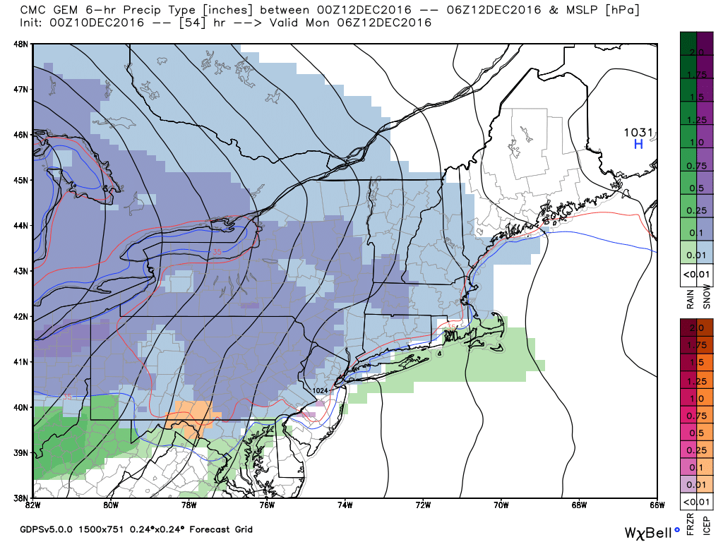
Snow totals are likely to end up on the higher range of the map I posted last night especially near the coast where heavy snow continues to fall despite earlier predictions of rain. Some mix is still possible but will likely be less expansive than forecast.
Snow and mixed precip will move out this afternoon with some peeks of sun possible this evening in the west.
Just a quick update on tomorrow’s snow forecast to arrive tonight and continue into early tomorrow afternoon. Not a whole lot has changed since this morning but here are my latest thoughts. I explained the dynamics at play in a post yesterday morning and the factors I outlined there are still at play. If you’re interested on learning a little more about the “why behind the what”, be sure to check that out. Otherwise, here’s a brief outline of what to expect in the next 24 hours.
HRRR Showing Snow Arriving Late Tonight. Credit: Weatherbell
Light snow will arrive late tonight from SW to NE and by dawn everyone will be seeing light snow with 1-3″ of accumulation. Between 7 and 8 AM, the coastal front (aka rain snow line) will begin moving onshore. Exactly how far it makes it remains unknown but for those on the warm side, expect a change to rain mid morning with accumulations limited to 1-3″. For those on the cold side, snow will pick up in intensity during this time with more snow expected.
Swiss HD Model Showing A Sharp Coastal Front Tomorrow Morning. Credit: Kachelmann
The exact position of the coastal front remains unknown but it’s a good bet that the midcoast will be on the warm side and I-95 will be on the cold side (outside of York County). In between (Portland, Yarmouth, Brunswick, etc.) the forecast remains more or less a tossup if the front works inland before the precip departs. If it does, look for a period of rain that will keep snowfall to 2-3″. If not, snowfall could keep piling up into the 4-6″ range. Regardless, a period of sleet and/or freezing rain is likely right at the tail end of the event which should be between noon and 3 PM.
Current NWS Warning/Advisory Products. The Coast Is Also Under A Coastal Flood Advisory Which Isn’t Shown On The Map. Credit: NWS
Winter storm warnings (pink) and winter weather advisories (purple) are posted for various parts of the area. Roads will be extremely slippery during the AM commute tomorrow with falling snow adding to the mix of hazardous driving conditions. A coastal flood advisory has been posted for the coastline though no significant coastal flood impacts are expected outside of some minor splashover in exceptionally vulnerable spots. Precip will wind down tomorrow afternoon from SW to NE and by sundown the entire area should be dry with slightly cooler air moving in.
Updated Snow Map.
Here’s my latest snow forecast. I think 10″ will be a stretch even for the mountains but I definitely think we’ll see many 8-9″ amounts out of that area. Otherwise not much has changed.
Today will feature cold temps, increasing clouds, and dry conditions as high pressure slides south and east ahead of our next storm system. Current temps this morning range from 9 above in Portland to 2 below at several mountain locations. These temps will warm quite a bit today but still won’t get warm per se. Highs will range from 20 in the north to 30 in the south. Skies will begin mainly clear but will become overcast by this evening as low pressure approaches from the west.
I went over the dynamics of the storm in detail yesterday morning and little has changed since then. The basic overview is that snow will move into the area very late tonight and will become moderate to heavy by tomorrow morning. By mid morning tomorrow, warm air will be pushing onshore and causing the snow to mix with rain along the coast. Farther inland, moderate to heavy snow will continue until the system moves out mid afternoon tomorrow. My updated snow map is below.
Snowfall Forecast For Tomorrow’s Event
A period of freezing rain is also possible along the coast tomorrow. While accumulations won’t amount to much (>.1″), the additional coat of ice will make travel even more hazardous tomorrow during the morning commute.
No more significant storms are on the horizon this week but a shot of very cold air looks likely for the latter part of the week. By Thursday/Friday, high temps may struggle to reach 15 degrees even in the south.
Today will feature more sun than clouds along with chilly temps and continued NW breezes. Highs will range from around 20 in the north to around 30 in the south. NW breezes will gust to 25mph at times as cold air continues to move into the area from Canada. No precip is expected but a few upslope flurries can’t be ruled out. Today’s cold will be setting the stage for what appears to be a fairly impactful winter weather event on Monday.
Snow will move into the region late tomorrow night and will continue into Monday. Everyone will start out as snow with a few inches expected by daybreak Monday. After that, the forecast becomes trickier for southern and coastal areas as warm air threatens to intrude enough to cause some mixing with sleet or rain. Any mixing will be limited to the coast, southern York County, SE NH, and the midcoast.
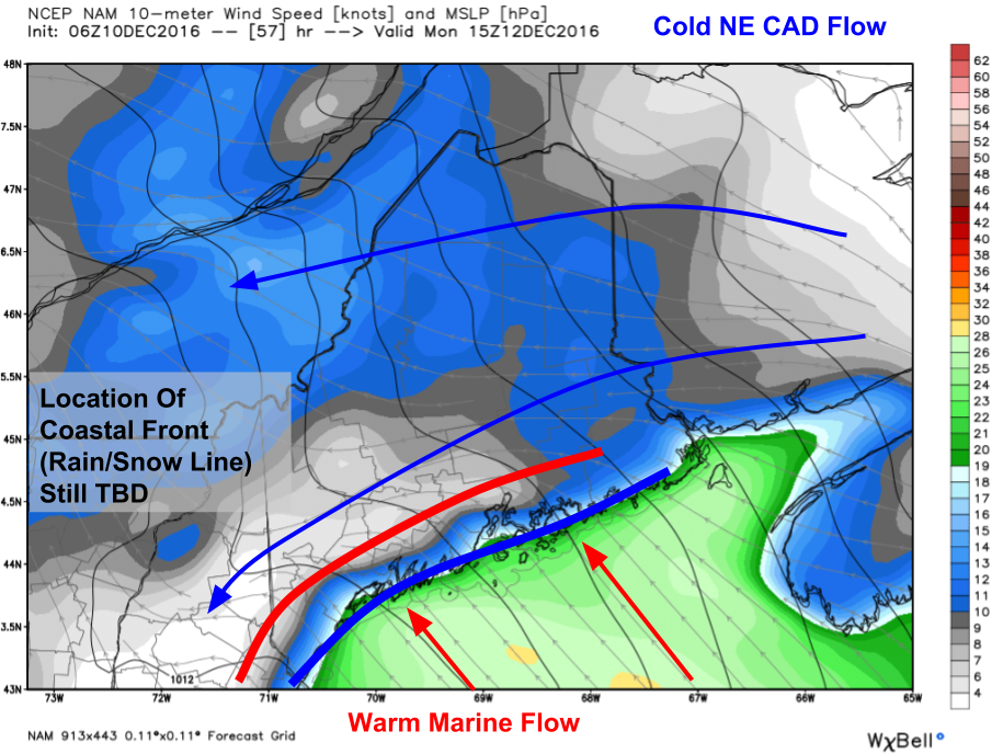
6Z NAM Showing Uncertainty In Position Of Coastal Front (Rain Snow Line). Credit: Weatherbell
The snowfall forecast for the coast will hinge on the westward progress of the coastal front which is the boundary between warm marine air and cold continental air. Most models currently bring it into the I-95 corridor but guidance has a notorious warm bias with these types of events. The immediate coast will likely mix regardless but I think the front will set up closer to rt 1/the beaches. Exactly where the coastal front sets up will determine who sees 4-6″ of snow and who barely gets 2″. Those who have lived in this area for a while know that the difference between the two can sometimes be a mile or two.
0Z NAM Showing Intense Mid Level Temperature Gradients Monday Morning. Credit: Accuweather
Snow will be light to moderate Sunday night into early Monday morning but a period of moderate to heavy snow is likely Monday morning into the early afternoon. This will be driven by intense lift as a result of a sharp temperature gradient between very mild air to the south and the remains of the very cold air we’re currently enjoying. The NAM highlights this gradient though I think it mishandles the northern extent of the warm air which will likely be sliding east faster than moving north due to another important feature.
6Z NAM Showing Intense Lifting As A Result Of Sharp Temperature Gradients Monday Morning. Credit: Accuweather
The intense lifting associated with this gradient is evident in the mid level vertical velocity field on the NAM model. This map shows how much air is rising and how fast it’s rising. Notice the reds and oranges over ME/NH late Monday morning. This isn’t the bright pinks of an intensifying Nor’easter but nonetheless it points to a period of moderate to fairly heavy snow on Monday morning that will be sure to cause a mess on the roads.
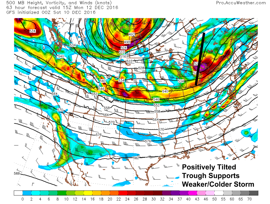
0Z GFS Showing A Positively Tilted Trough Conducive To A Weaker/Colder Storm. Image Credit: Accuweather
Those who have read my discussions for a while know that I often focus on the behavior of troughs and ridges at 500mb (~25,000 feet) to determine how storms at the surface will behave. Monday’s storm has weak upper level support at both the 500mb and 300mb levels. The positively tilted 500mb trough means that there isn’t enough energy for a storm to strengthen. Weaker storms have a harder time uprooting well entrenched cold air like that sitting over New England now.
The 300mb jet stream shows the same thing. The jet across all of North America is blowing from west to east in more or less a straight line. This is known as zonal flow and favors weak, fast moving storms like the one coming Monday. As I said before, weaker storms have a hard time uprooting cold air and the upper levels are indicating the storm Monday will be of the fairly weak variety.
All that to say that the storm coming Monday will bring a burst of snow Monday morning right around commute time that will possibly mix with rain along the coast. The storm will have a hard time uprooting the cold air now in place across the area because the upper level pattern indicates the storm will be fairly weak. How about accumulation?
Forecast Snowfall Sunday Night-Monday.
Here’s my forecast for accumulation. The foothills and mountains will be the jackpot and there will likely be a few places in the Mt Washington region that see 6-8″ but most folks are likely to see 3-6″ with lower amounts along the coast where some rain is possible and up near the Canadian border which will be farther removed from the heaviest snow.
Today’s weather will feature the passage of a strong cold front and all the cold air and gusty winds that goes along with that. Look for highs to be set in the morning hours as temps will hold steady or even fall through the day. By the evening, expect the mountains to be in the 10’s and the coast to be in the 20’s. The mountains will also get to enjoy some more upslope snows with 3-6″ of accumulation in the favored areas. NW winds will be gusty today so watch for wind chills that will be even colder than the actual temperature. Skies will range from mainly cloudy in the north to mainly sunny along the coast.
In the event that it hasn’t been cold enough for your tastes, I’ve got good news! Today’s 30’s will be a distant memory in 48 hours as our first true arctic front moves through tomorrow. Before that though, we have one more relatively mild day today. Look for a mix of sun and clouds along with temps in the upper 20’s to low 30’s north and mid to upper 30’s south. We will have mainly dry conditions but everyone could see a brief flurry this evening as the front begins to approach and the mountains will stand a better chance for light snow which could accumulate to an inch up in the north and at elevation.
Today will feature mainly cloudy skies along with some light flurries this morning. No impacts are expected from the occasional flakes but they could accumulate to a dusting on grassy or previously snowy surfaces. They should dry up by the afternoon hours. Highs will range from the mid 20’s north to the mid 30’s south under overcast skies. Winds will be light out of the north east.
Today will feature an icy and frigid start with current temps below 20 degrees in most areas. Temps will warm through the morning hours before topping out in the mid 30’s south and upper 20’s north. Skies will feature a mix of sun and clouds that will skew towards the sunny end of the scale for most of the day. Some more clouds are likely this evening as our next potential flurry-maker drifts in from the west. It will be engaged in the highly annoying act of dissipating as it gets to us so its impacts tomorrow are likely to be limited to flurries though that could change with some mesoscale enhancement like we saw yesterday.
Today will feature, for the first time this season, widespread accumulating snow! It is not forecast to be a large storm by any means and most folks will end up with less than 3″ but roads will be slick nonetheless and everything will get a beautifully festive coat of white. Snow is already falling across southern NH and will arrive in ME by 8-10 AM. Snow will be light to moderate at times throughout the day before tapering off this evening around 3 PM in the west and around 7 PM across the midcoast where the last few bits of precip could fall as raindrops. Other than a few drops along the coast, this is expected to be a mainly snow event.
Swiss Super HD Model Showing Light Snow Arriving Ar Around 9 AM In Portland
Here is a super high-resolution model run by a Swiss weather company showing the snow arriving this morning. Notice that the snow is light to moderate in nature and that even the coast is mainly snow.
I’m very excited to announce that beginning this spring I’ll be writing about national weather for the Swiss company’s new US website! I’ll also be helping to improve the model which you should definitely check out on their existing site. It looks like when I begin writing for the new site, my blog here will have to undergo a little bit of rebranding but I still plan on doing a local Maine/NH forecast for those interested. I’ll have more info on where to find that when it becomes necessary.
Many thanks to everyone who has supported me along the way!
Today will feature chilly temps, breezy NNW winds, and mainly sunny skies outside the mountains. Look for more classic upslope/downslope conditions with light snow showers continuing in the favored mountain regions. Highs will be a bit cooler than yesterday with upper 20’s to low 30’s north and mid to upper 30’s south. Skies will be mostly sunny outside of the mountains where upslope clouds are expected to continue.
Some light snow is possible in SW areas tomorrow but no significant impacts are expected.