
Hello everyone!
Today will feature the ‘intermission’ of our current winter storm, as the system transitions from its old center near Michigan to its new center south of Long Island. That means that we’ll see a bit of a break in the action today before the second act begins this evening.

Radar imagery this morning shows a band of snow struggling to move north of Portland, which is about where it will stay for the rest of the day. Click the link above for the latest radar imagery to see where it’s snowing now. If you look closely enough, you can see some ocean effect snow moving onshore south of Portland as cold NE winds move over the warm Gulf of Maine. As I mentioned above, I think the radar will continue to look fairly similar to this until the evening. If you’re north of Portland, expect dry and overcast conditions. If you’re south of Portland, expect light snow accumulating 1-3″.

Here’s a look at the dynamics behind today’s weather. A disorganized area of low pressure with two dueling centers will be located to our south, as shown by sea level pressure (grey lines) and 10m wind analyses (black arrows). Forecasts for the relative humidity around 2,500 feet above the ground show a strong wedge of dry air in place across all but far southern York County and adjacent parts of southern NH. This means snow will be confined to areas south of Portland until the storm can organize further and throw better moisture/lift our way.
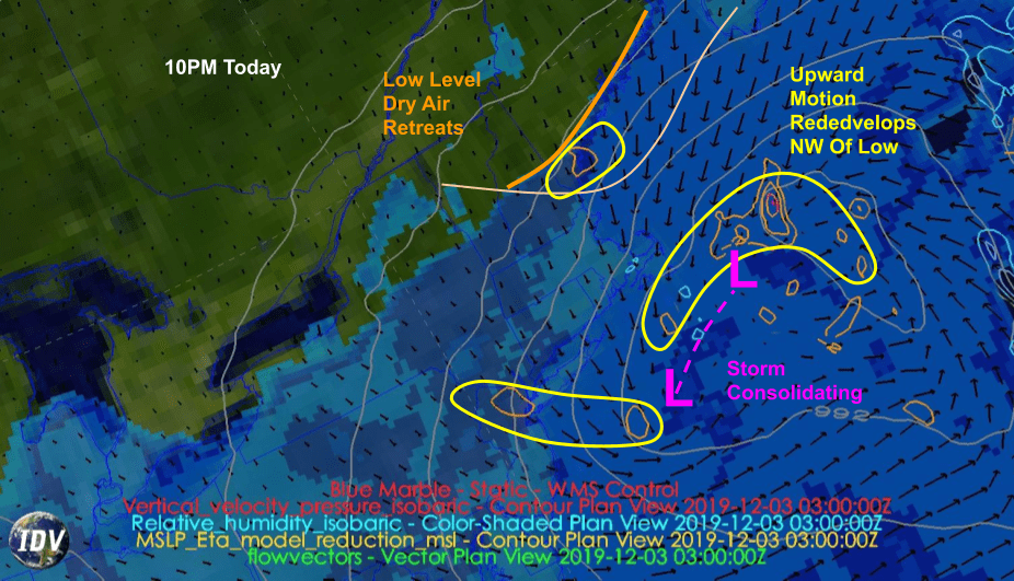
That process will begin tonight as the storm consolidates SE of Cape Cod. The low level dry air will retreat a bit as the storm strengthens and some bands of snow try to push our way. Overall I think meaningful accumulation resumes in SE NH/SW ME after around 8 or 9 this evening.

The storm will finish its process of reorganization tomorrow morning and will begin strengthening as it moves east of Cape Cod. This means we’ll be located under an area of strong mid-level deformation where winds blowing in opposite directions run into each other. The result of this collision will be upward motion, and a band of very heavy snow. Right now it looks like the coastal plain NE of Portland has the best chance of sitting under this band of heavy snow, which could drop more than 6″ over the course of just a few hours.
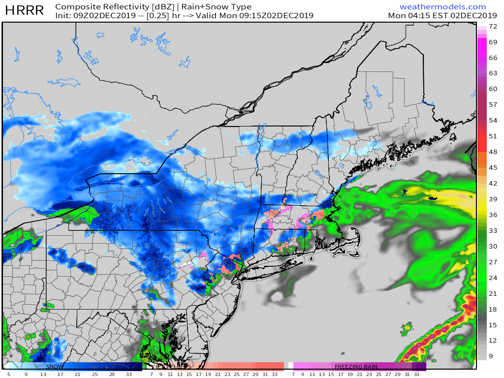
Here’s a look at how this process is expected to evolve between now and 10 this evening. Note the persistent light snow/mixed precip over southern NH today before bands of snow begin to move into coastal Maine later this evening. Even heavier bands of snow will arrive tomorrow morning, which will likely result in disruptions to schools.
I’ll have another look at those morning bands around this time tomorrow. High temps today will range from 25 in the north to 30 along the coast.
-Jack
