
Hello everyone!
Today will feature light snow as a weak storm system moves to our south. Snow won’t be very heavy, but it will fall somewhat intermittently for most of the day and by the time the storm moves out tonight, most areas should end up with a few inches. Radar imagery indicates that snow has moved into NH and SW parts of ME this morning, but surface observations from 6 AM only show snow making it to the ground in SW NH. The rest of the area will have to wait another few hours for the snow to work its way through a layer of very dry air near the surface.
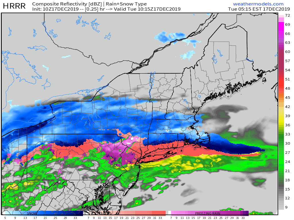
Here’s an illustration of how the snow evolves throughout the day. Note that there will be brief bursts of moderate/heavier snow, but they won’t tend to linger over any given place, and there will be plenty of time that snow falls very lightly, or perhaps even stops entirely. It also should be noted that a brief period of mixed precipitation is possible along the NH/MA border this evening.

As far as snow accumulations go, this is the latest NWS forecast and I don’t see any major issues with it based on my analysis this morning. Highest totals around 4-5″ will be found in Maine’s Cumberland and York counties as well as southern parts of NH. As you head farther north, you start to run out of both moisture and forcing for ascent (upward motion in the atmosphere) which will keep totals to around 2″ in the mountains.
Another round of snow arrives tomorrow in the form of squalls along a strong Arctic front.
-Jack
