
Hello everyone!
New England weather is often fickle and the conditions you experience often depend considerably on your location. Today, we’ll see that maxim put on steroids as a very sharp frontal boundary stalls out over the area.

Temperatures this morning highlight this contrast well. Most of NH is relatively warm this morning, ranging from around 40 in the north to just shy of 65 in the south. York County ME has joined in the warm air with temps around 60, but just north in Lewiston temps are barely above freezing. The cold air located over much of Maine will slowly try to work its way south today, but its ability to do so will be curtailed by the advance of the storm system responsible for this whole mess which is currently moving through upstate New York.
Thankfully, you have to travel a bit farther north before temps dip below freezing. The freezing line, as best I can tell from limited observations, is somewhere around Route 2, and it will likely remain there for the rest of the day. Just north of that line, freezing rain is falling this morning. Thankfully, it looks like the window of opportunity for ice accretion will end up being a bit narrower than we thought last night. That means that instead of around a half inch of ice accretion, most spots likely end up closer to 1/4 or 1/3 of an inch. While scattered outages are still possible, this small change in the forecast should alleviate the concern of power outages for most.
Precipitation will end from west to east after the passage of a cold front later this morning. In the south, breezy SW winds will shift towards the WNW while northern areas see light NE breezes flip around to the WNW and become a bit stronger. WNW flow will produce a bit of downslope-induced clearing along the coast, but otherwise expect overcast skies today.
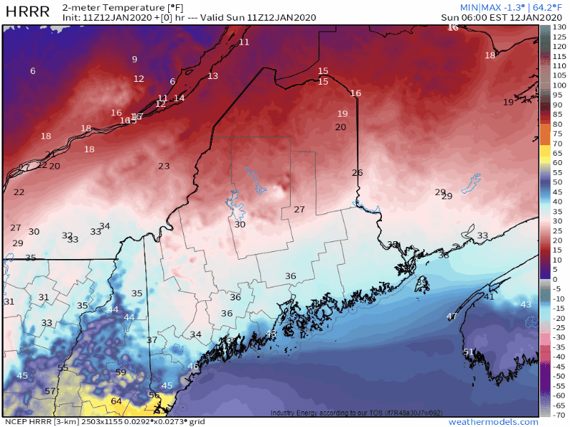
Temperatures, especially in the south, will fluctuate several times today so instead of spending a long paragraph explaining exactly what temperatures will do in a given location, I’ll leave you with this animation showing the HRRR’s forecast for temperatures each hour today beginning at 6 AM and ending at 7 PM. I find the temperature gradient over York County this afternoon particularly interesting. Over just 10-20 miles, the temperature will range from almost 70 to around 40!
Quieter weather returns tomorrow.
-Jack
