
Hello everyone!
Today will feature the arrival of our next winter storm which will bring a prolonged period of snow, sleet, ice, and rain today and tomorrow.
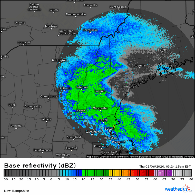
Radar imagery shows steady precip ongoing across the area this morning. From what I can tell, this is falling as snow across the entire area and generally falls under the “moderate snow” category. This round of snow will be relatively short-lived (notice the drier air already working into western NH) as the weak lead disturbance responsible for producing the snow moves quickly east. Most spots should end up with 2-4″ of snow by the time precip tapers off mid/late morning.

Early this afternoon, expect little organized precipitation as we sit between the first wave (departing into Canada) and the second (still developing well to our south). Low level moisture may produce some freezing drizzle, but aside from slick untreated surfaces, impacts during this time should be relatively minimal.
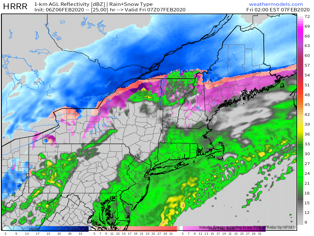
Round two of this storm will arrive in the early morning hours tomorrow as steady precip returns. That round of precip will likely fall as sleet/snow up north, rain in southern NH/coastal SW ME, and freezing rain for everywhere in between. While a significant ice storm isn’t expected, a few spots in central NH/interior SW ME could see between 1/4 and 1/3″ of ice accretion. That’s generally not enough for major power disruptions, but scattered outages can’t be ruled out.
I’ll have more info on tomorrow’s half of the system tomorrow morning.
High temps today will range from 25 in the mountains/foothills to around 40 along the NH Seacoast.
-Jack
