
Hello everyone!
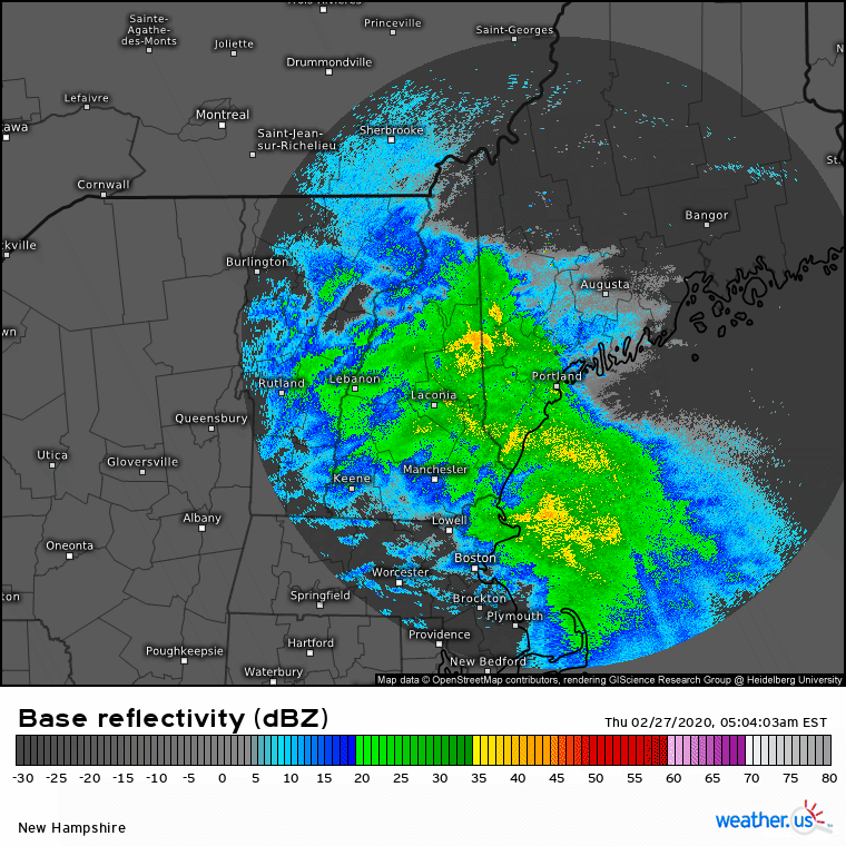
After several days of quiet weather, it’s finally time for our next storm. This one is already impacting the region with moderate rain and snow as of 6:15 AM.
Rounds of heavier precipitation will arrive from the south over the next couple hours ahead of the storm’s occluded front which will be moving northeast. Behind that front, dry air will quickly race into the area and shut off precipitation. For SW NH, this could happen as soon as 8-9 AM. For Portland, this will likely happen around 11 AM or 12 PM, and for northeastern parts of the region, precip will linger until 2-4 PM.
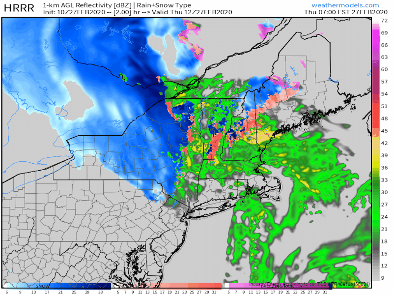
This simulated radar loop from the HRRR highlights the rapid forward motion of this system. Most of the precip in any given area will fall over a roughly 6 hour period. For the coast and southern foothills, this means a period of moderate to possibly heavy rain. While some ponding on roads is possible, I don’t see any major impacts from the warm side of this system. For the mountains, this heavy precipitation means extremely high snowfall rates possibly in excess of 2″ per hour at times this morning. Be sure to take it easy out on the roads if your plans take you into the hills north of route 2 this morning.

As far as accumulation goes, here’s what the NWS is expecting for this storm. As usual, every forecaster would draw their lines slightly differently but overall my thinking is very much in line with theirs. The southern half of the area will remain plain rain with no snowfall accumulation while the mountains hang onto the cold air end end up with 8-12″ or possibly a little more. The cutoff between 0″ of snow and >6″ of snow will be remarkably tight with this system. That divide should set up just northwest of a Fryeburg-Augusta line.

As this system is rapidly intensifying, it will bring plenty of gusty winds to the region both out of the east-northeast ahead of the occluded front and out of the west-southwest behind it. So far Portland has gusted around 40 mph which is blustery but nothing too out of the ordinary. I wouldn’t expect any widespread disruptions to power from these winds, but some outages are possible in the mountains where trees and lines will be weighed down with the heavy snow.
Calmer weather will slowly return tomorrow.
-Jack
