
Hello everyone!
Today will feature the long-awaited arrival of Tropical Storm Isaias as it races up the East Coast ahead of an advancing trough over the Great Lakes. While the storm center is still located way down near the NC/VA border (as of 6 AM), moisture is streaming well north thanks to strong southerly flow aloft. The net result for us is that clouds are already thick across the region this morning, and will remain that way through the rest of the day.

Zooming out on the radar imagery this morning shows an impressive plume of heavy rain extending from the storm’s center (south of Richmond, not quite in the frame here) all the way up past Ottawa and Montreal. Note that the heaviest rain is focused away from the coastline in the Mid Atlantic and west of the Hudson River in New York. This general trend will continue as the storm races towards Quebec City today. If you’re to the west of the track, you’re mostly concerned about heavy rain. If you’re to the east of the track, you’re mostly concerned about strong winds. Because the storm is headed west of us, we’re mostly concerned about the wind. That’s not to say there won’t be heavy rain, it will just likely remain below the levels needed to cause major flash flooding concerns.
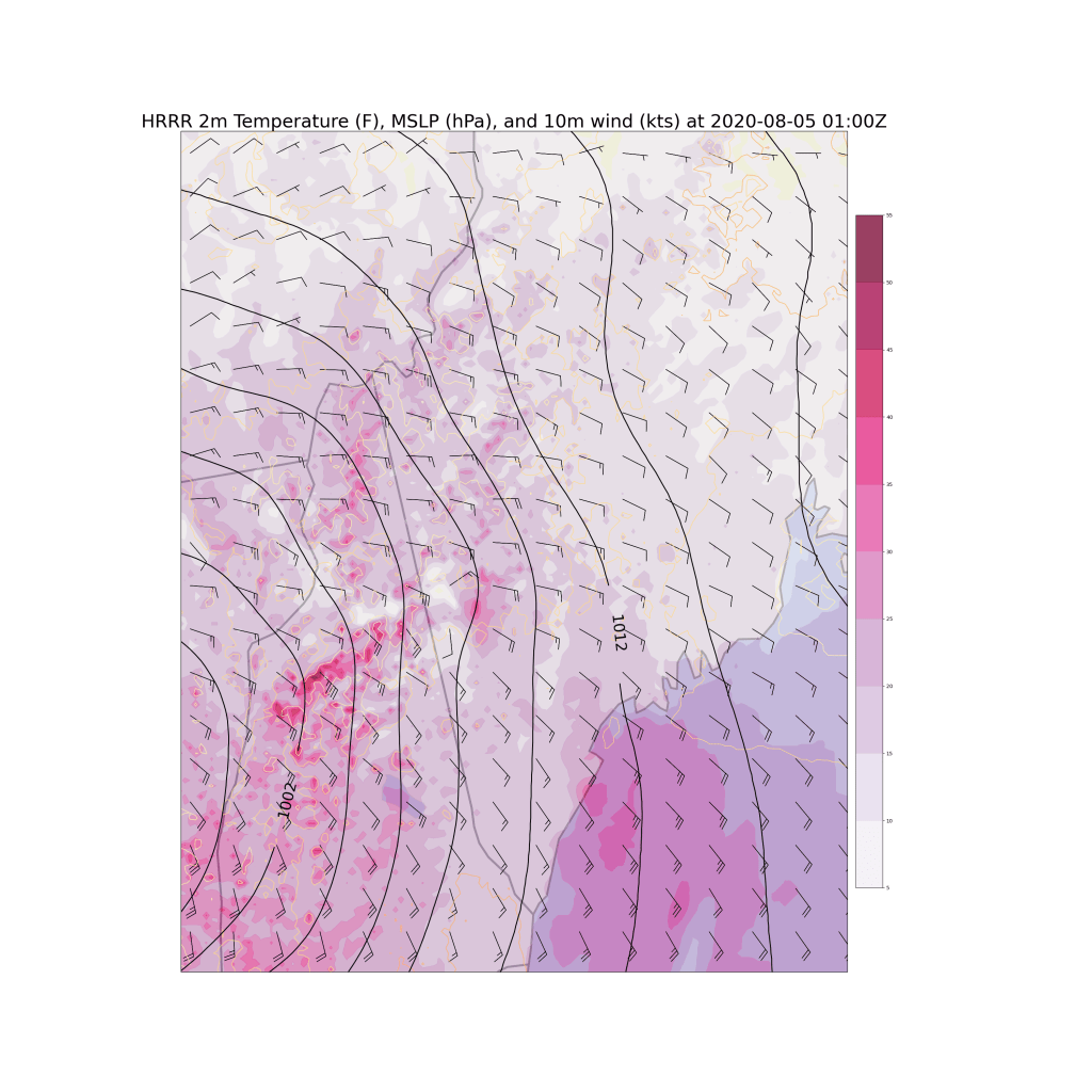
Forecast model guidance (this map valid 9 PM) suggests that as the storm moves through Vermont, we’ll see two areas at risk for particularly strong winds: western NH (closer to the actual circulation) and the coastline (less friction). Both of these areas will likely gust over 50 mph, resulting in tree damage and power interruptions. For spots in between or farther northeast, gusts should stay in the 35-45 mph range which could cause a few isolated issues, but likely won’t support widespread impacts.
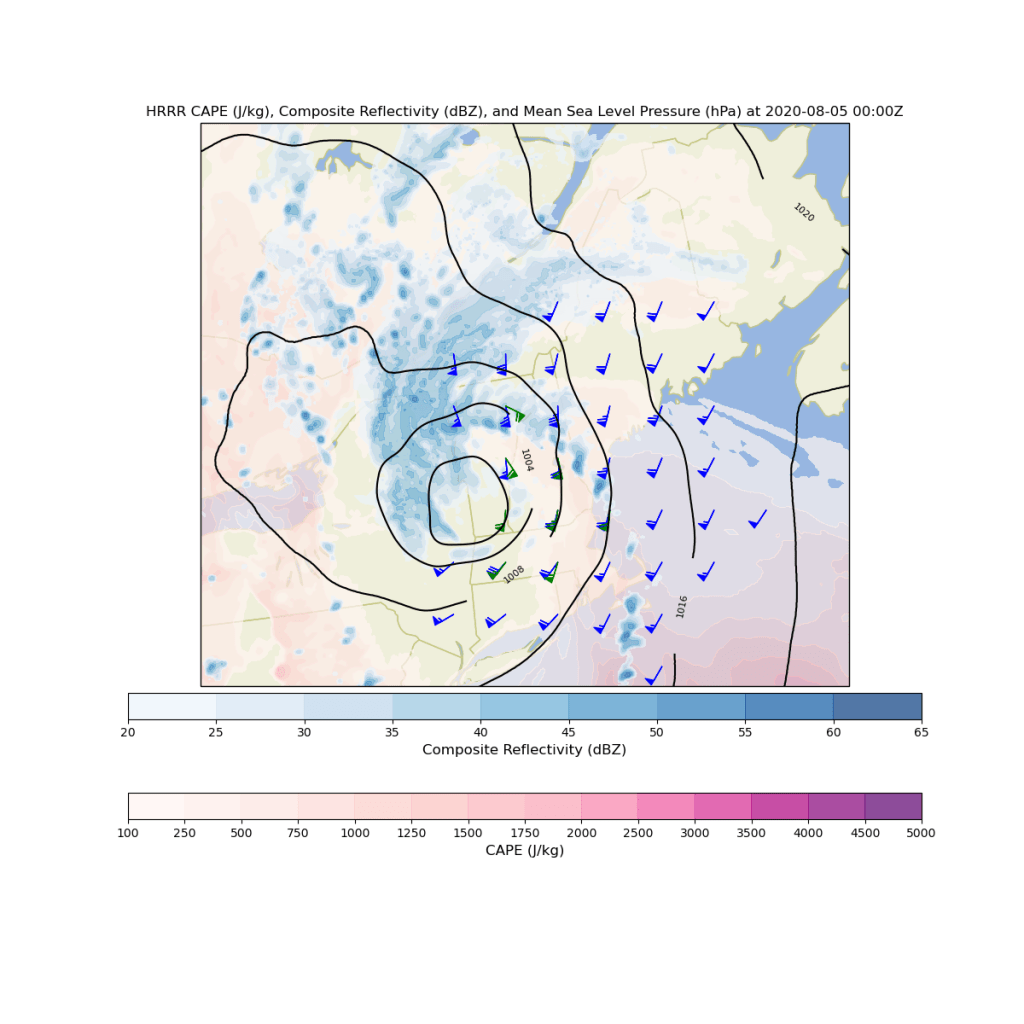
The other threat we’ll have to think about is that of tornadoes. On the eastern side of the storm, we’ll have some instability (shaded in the peach-ish color on the map above), abundant wind shear (pretty much off the charts for our region), and a line of thunderstorms moving northeast associated with the outer bands of Isaias. This storm has already produced numerous tornadoes as it moved ashore in North Carolina last night, and all indications are that this will continue as the system moves up the coast. The SPC (Storm Prediction Center, like the National Hurricane Center but for severe storms) has outlined our area as having a significantly-above-normal chance to see a tornado this evening.
What does this mean for you? You should have a way of receiving NWS tornado warnings if they are issued for your location, and you should be ready to move to your basement or an interior room on the first floor with no windows. Tornadoes will develop and dissipate rapidly so despite the best efforts of our friends up at NWS Gray, you might not have much time to act once a warning is issued. Remember that statistically speaking, your odds of getting a tornado tonight are still quite small. The vast majority of us probably won’t even get a warning. But it’s good to be prepared in case that happens, especially on a day like today when the risk is much higher relative to normal.
As far as timing goes today, expect showers to continue through the rest of the morning and into this afternoon. Generally, coverage and intensity of rain will tend to decrease as we move towards the later afternoon hours. Then this evening, the main part of the storm will rotate through in the form of that outer band which will bring briefly heavy rain, strong winds, and the threat for tornadoes as it moves northeast between 7-8 PM (SW NH), 8-9 PM (central NH/SW ME), and 9-10 PM (points north/east). Gusty winds will continue overnight before calming down tomorrow.
Temps today will be a bit on the cooler side thanks to all the clouds and southeasterly flow off the (very warm but not yet hot) Gulf of Maine. Look for highs ranging from the upper 60s/low 70s north to upper 70s/low 80s south.
-Jack
