
Hello everyone!
A strong cold front moved through the region last night which means cool air is on the way for today. The high pressure system responsible for this cool air is on the stronger side, and the remnants of Hurricane Sally are moving by to our south, so northerly winds will get fairly gusty today. I wouldn’t expect to see widespread tree/power issues but a few spotty outages can’t be ruled out. Most of the region is stuck under a low/mid-level cloud deck this morning, but that should clear out by midday. Sunny skies will then be the rule across the area, though that won’t exactly do much for our temperatures. Look for highs in the mid 50s up north and the mid 60s in the south.
Meanwhile well to our south, Major Hurricane Teddy still bears watching this morning.
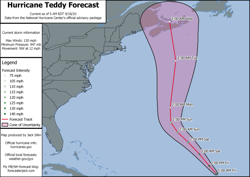
We’re not pawsitivly certain where this one will end up, but it looks to be in our general vicinity on Tuesday. The current NHC forecast is shown above and takes the storm into Nova Scotia as a powerful but barely extratropical hurricane. While we’ll certainly have to watch for any shifts west in the forecast track, at this point I do not expect the storm’s worst impacts to spread into our area. That said, we will likely see a period of breezy winds (potentially enough for power outages) as well as potentially some rain. The biggest story though will be the massive waves the cyclone looks to push our way starting on Sunday-Monday. Some of the wave forecasts are pretty incredible, especially if the storm becomes cut-off from the jet stream and meanders over the outer Gulf of Maine for a day or two. So for the pro surfers, wax up your boards and get stoked. For the rest of us, stay well away from the ocean!
-Jack
