Hello everyone!
Another storm is on the way this morning as low pressure moves up through the Great Lakes. This track puts us on the warmer side of the system, but with such cold air in place across the region, we’re still likely to see some wintry precipitation.
Overcast skies and quiet conditions will be the rule this morning as temps warm from the single digits and 10s as I write this a little after seven to the mid 20s north/low 30s south by around noon.

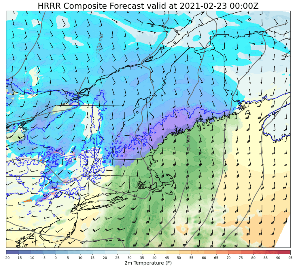
This forecast graphic valid at noon shows a few flurries breaking out over the area ahead of the main precipitation shield as southerly winds (the little things shaped somewhat like the letter “L” tell you the wind speed and direction, with the long axis parallel to the wind direction and the little notches on the upwind side marking off wind speeds in increments of 5 and 10kts with short and long notches respectively) push temps near/above freezing along the coast.

By 3 PM, steady precipitation will be underway across most of the area with flakes and raindrops just starting to fall northeast of Portland. The freezing line will likely make some inland progress during peak afternoon heating, but I remain a little skeptical about just how far it will make it. There are a couple reasons for this: cold air damming is least effective on a southwest wind in our area (that’s what we have this morning), but a deep snowpack extends well to our southwest, so incoming air is not as warm as it appears. By the time winds shift around to the south/southeast this afternoon, we will be able to tap into a source of warm air (the Gulf of Maine), but cold air damming will start to kick in with that wind direction. Additionally, as precip starts to fall into the currently-dry airmass, evaporation will induce cooling in the low levels.

By the time heavier precipitation arrives this evening, evaporation, cold air damming, and sunset should drive temps to near freezing for everyone away from the coastline. Snow will fall heavily at times for a couple hours around 5-8 PM which could cause issues on the roads, especially inland and farther north. While I am bullish on the cold in general, I do think it will take a while for the immediate coast to cool off enough for snow, so accumulations will be much more limited there.

Later this evening, a secondary low will form south of Rockland which will prolong heavy precipitation near Penobscot Bay and will help facilitate some cooling as winds turn around to the east/northeast once it gets going. So I think that in addition to the usual jackpot up on the southeast-facing slopes of the Whites and the mountains of Maine, the Camden Hills look pretty good for a secondary max in snowfall totals. Keep in mind that snow especially along the coast will be heavy and wet with this system, so take care shoveling.
The system will depart in the early morning hours with calm weather returning tomorrow.
So how much snow should we expect?

I think most spots will come in between 1″ (along the coast) and 4″ (foothills). Strong southeast winds will support totals closer to 6″ in the higher terrain from the White Mountains up towards Sugarloaf, while the higher elevations of the Camden Hills should be able to rack up 4-6″ with that secondary low. Along the coast, mixing with rain will hold totals down, especially as you get east of I-95 and south of Route 1.
-Jack
