I’m a third-year atmospheric science student at Cornell University who has been blogging about the weather since 2011. While I’m not officially a meteorologist, I have accumulated a bit of experience forecasting both local weather (in western Maine and New Hampshire) as well as national/international weather during my time writing for weather.us and weathermodels.com. I also have experience programming in Python, teaching concepts in weather forecasting, and communicating forecast information to general audiences.
Today will feature more cool temps and unsettled weather as a weak area of low pressure races through southern New England. Overcast skies are being observed across the region this morning and clouds will generally rule the day though a few breaks of sun are possible right around sunset. These clearing-at-dusk days often produce great sunset photography opportunities, so get your cameras ready!
In addition to the clouds, this system is also pushing some precipitation through southern parts of the region this morning. With cool temps and cooler dew points, most of this precipitation is falling as snow (except perhaps right along the shoreline). So far, no snow has been reported north of Portland but a few flurries could make it as far north as Fryeburg/Lewiston/Rockland. Any accumulations will be limited to interior York County and adjacent parts of southern NH where a quick 1-3″ is likely. Snow will taper off later this morning.
High temps will remain chilly today due to the cloud cover, precipitation, and northerly winds. Look for highs across the region to top out between 40 and 45.
Today’s forecast looks a whole lot like yesterday’s as morning sunshine will provide just enough heat for some shallow convection (rain/snow showers) in the afternoon. Look for high temps similar to yesterday’s, ranging from the mid 30s in the north to around 50 in SE NH. While yesterday’s showers faded to clear skies around sunset, today’s will fade to overcast as the next storm system to graze the region approaches rapidly from the SW. This will bring a quick round of accumulating snow to southern parts of the area later tonight into early tomorrow morning.
Today will feature continued cool weather as westerly winds around the southern side of our windstorm from Monday continue to push cool Canadian air through the area. A weak disturbance embedded within the flow around that low is moving through MA this morning. The northern edge of that system is bringing some light snow to southern NH. It’s possible for some towns right along the MA border to pick up a dusting-1″ in the next couple hours before the system quickly moves offshore.
Any snow that does fall will melt quickly as the sun comes out behind that disturbance and temps warm into the mid/upper 40s outside the mountains (where upper 30s/low 40s are expected). Those warmer temps will support some weak instability as very cold air moves in aloft. As a result, expect clouds and showers to pop up around/after noon. Those showers will fall in the form of snow for most of the area though a mix of rain/snow/graupel is more likely along the coast. No accumulations are expected from these showers.
Today will feature continued cool weather and breezy west/northwest winds as a series of cold fronts move offshore. The first boundary is already southeast of the area and is bringing rounds of steady rain to far SE MA this morning. Light NW flow is being observed behind this feature. A few radar echoes over the mountains indicate a flurry or sprinkle can’t be ruled out, but there’s no reason to believe any more than that would reach the ground.
The second boundary is currently moving through the Great Lakes and has little to no precipitation associated with it. This will cross the region later in the afternoon with little more than a mountain flurry and an eastward retreat of the sea breeze front. The first boundary has much more in the way of cloud cover associated with it so we should see clearing skies beginning mid/late morning. The second boundary might be able to generate a few cumulus clouds if that.
Temps will remain on the chillier side of normal as unseasonably cool air has flooded most of North America east of the Rockies. Look for highs ranging from 35 in the mountains to 50 along the coastal plain. As usual, the midcoast will be a bit chillier around 45.
Today will feature the well-deserved return of quiet weather as yesterday’s storm continues to intensify (!) east of James Bay. While westerly breezes are in progress across the area as a result of that system, they won’t be nearly as strong as yesterday’s southerlies. Gusts should stay below 25 mph meaning the risk of additional power outages is quite low. Those westerly breezes have kicked up a few upslope clouds in the usual spots but otherwise the region is mostly clear this morning. A few high clouds are beginning to develop back to our southwest ahead of a weak upper level disturbance sliding through the Southern Plains. Expect those clouds to slide in our direction later today. While many of us (especially southwest) will likely end up with overcast by this evening, no precipitation is expected.
High temps will settle right around climatological norms today, ranging from 40 in the north to 55 along the coastal plain. The immediate shoreline will remain a bit cooler (45-50) due to a late afternoon sea breeze.
Hopefully everyone took advantage of the nice weather yesterday to batten down the hatches ahead of today’s storm. That storm is currently developing rapidly over the Great Lakes and will be responsible for bringing a wide variety of wild weather to the area today.
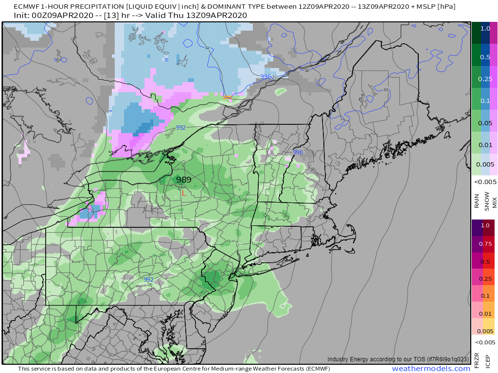
Radar imagery this morning shows steady rain approaching from the southwest while showers pop up ahead of the main line. Those lead showers look to be fairly heavy while the steady rain seems much lighter. The only mostly dry part of the region this morning is the northern mountains which will see rain beginning in the next 1-2 hours.
Rain will continue steadily for most of the day, with perhaps a few drier breaks early afternoon between bands. Most spots will pick up 1-1.5″ of rain from this event with 2″+ totals expected along south/southeast facing slopes of the mountains and possibly also along the coastline. This amount of rain will be enough to push small rivers/streams to bankfull or perhaps a bit over. If you live in a low-lying area near a river or stream that usually floods in heavy rain events, prepare for high water. Otherwise, be mindful of high water on roadways if you need to head out.
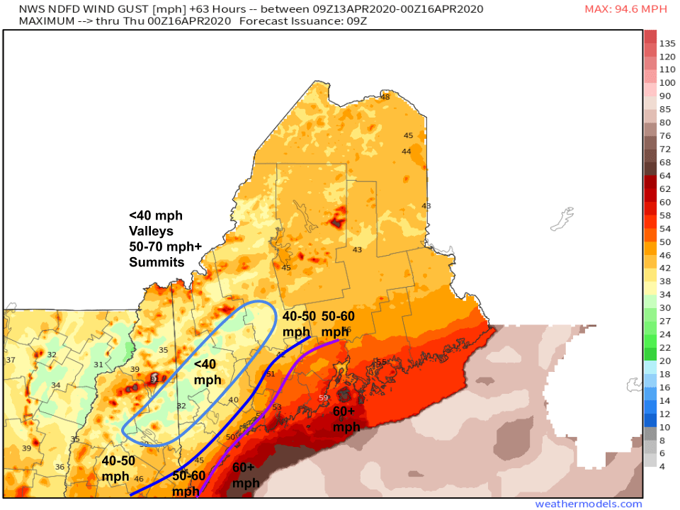
By far the bigger impact from this storm will be the wind.
Winds just above the surface today will be nothing short of incredible. Sustained winds along the coastal plain will be rocking 80-100+ mph just 2,000ft above the ground. The big question is to what extent can those winds mix to the surface (or pine-tree-level).
The answer will be found in low-level temperature profiles. If temperatures warm with height, it’s really hard to get high winds to the surface because fast-moving lower-density warm air doesn’t want to punch through a layer of slower-moving higher-density cold air. However, if temperatures are nearly constant with height (or cool with height), that higher-momentum air can reach the surface much more easily.
That’s where the shading on the map I made above comes in. Red areas represent regions where temps warm with height. That makes sense as the Gulf of Maine is chilly this time of year so over the ocean, the surface (water) is cold while warm air moves in aloft. Over land however, temperatures are either constant or cooling with height especially over the Coastal Plain east (or within a couple dozen miles) of the Turnpike. This is the area to watch for the strongest wind gusts.
How windy are we talking?
Here’s the NWS’ current forecast (shaded) and my thoughts (contoured). The foothills will be most sheltered from these winds due to weaker winds aloft and colder temperatures near the surface. Gusts there should end up in the 30-40 mph range. In the mountains, winds will be elevation-dependent with gusts in the 30s in the valleys and 50s-60s+ on the ridges/summits. The highest (lower elevation) gusts will be found along the coastal plain east of I-95. Overall I’m in good agreement with the NWS forecast except for the interior midcoast east of I-95 and north of route 1. I think that area is likely to see gusts >60 mph ad favorable thermal profiles offset slowing due to friction.
Either way, expect another round of widespread power outages beginning early/mid afternoon.
Rain and wind will both taper off this evening as the storm rapidly moves east.
Today will feature seasonable temperatures and increasing cloud cover as our next storm begins to intensify out in the Plains. High clouds have just about arrived in southwestern NH as I write this a little before 6 AM while low/mid level clouds lurk a bit farther southwest. We’ll see those mid/high clouds arrive this morning while low/mid clouds put an end to any filtered sunshine this afternoon. Winds will turn towards the south as high pressure slides offshore which means chilly temps continue for the Midcoast while temps rebound farther west. Look for highs ranging from 45 in the mountains and along the peninsulas east of Brunswick to 60 in southern NH. Precipitation associated with tomorrow’s storm looks to hold off until the early morning hours, even in SW NH.
Speaking of tomorrow’s storm, unfortunately it’s looking like another moderate to possibly high-impact event. As low pressure explosively intensifies in the Great Lakes, a whole lot of air will be set in (quite rapid) motion across eastern North America. A feature known as a “low level jet” (short for low-level jet stream) will develop over the area tomorrow morning bringing hurricane force winds to within a few hundred feet of the surface. The biggest question is how much of that wind can actually make it to the ground. At the moment, most of the coastline looks like a lock to see winds >40 mph. The Midcoast peninsulas will likely gust above 50 mph. Farther inland, friction and cold air damming will conspire to hold gusts <30 mph. I’ll have another update tomorrow morning with a refined forecast, but unfortunately it’s time to prepare for another round of power outages especially along the coast and east of I-95 north of Brunswick (“interior Midcoast”). Hopefully we’ll avoid the worst case scenario with these winds.
Today will feature cool temps and unsettled weather as Thursday night’s snowstorm drifts ever so slowly east through the Canadian Maritimes. While not nearly as strong as yesterday, NW breezes will continue across the area especially this morning. As a result, we’re seeing the typical low cloud deck established over the mountains this morning. Some of those clouds have even strayed towards the coastline. Look for the usual mix of sun and clouds across most of the area today with sunnier skies developing later in the day especially near the coast and cloudier skies remaining stuck over the mountains especially this morning. With low level moisture in short supply after yesterday’s squalls, the only precipitation likely today is some flurries in the mountains. High temps will remain chilly, ranging from 30 in the mountains to 50 along the NH Seacoast.
Our next storm arrives Monday with gusty SW winds and heavy rain.
Today will feature the slow departure of yesterday’s storm which means cool temps and unsettled weather for most of the region. One last heavy snow band is still pivoting East of Augusta, but even that should taper off over the next few hours. The main weather event today will be the development of low-topped squalls along a boundary pivoting around the western side of the low. These will initially pop up along a line from Waterville to Rangely in the late morning hours and will drop heavy snow as they begin to move southeast. As the squalls move towards the coast, they’ll run into warmer air near the surface. That means they’ll transition from snow squalls to rain squalls. It also means that they’ll have access to more energy. As a result, expect some rumbles of thunder and a precipitation type mix including graupel and small hail in addition to rain.
Behind these squalls, expect winds to rapidly pick up from the northwest. Most spots will likely see gusts top out around 40-45 mph. That’s definitely enough to cause continued power outages especially where trees remain snow-loaded.
High temps today will be chilly as the fresh snow limits how much the sun can warm the air and colder air pours into the region from the northwest. Look for highs ranging from 30 in the mountains to 50 along the NH coast. Most of the coastal plain should end up right around 40-45.
Calmer weather returns for the weekend before our next storm brings heavy rain to the region Monday.
Today will feature the arrival of a strong late-season winter storm as one area of low pressure falls apart over the Great Lakes and another explosively intensifies in the Gulf of Maine. This storm will bring heavy snow to the foothills and mountains while a mix of rain and snow falls along the coastal plain, and the coastline itself experiences heavy rain. Meanwhile, wind gusts will pick up especially along the coast east of Brunswick. This post will be a little longer than usual as I walk through the storm’s impacts step by step.
Radar imagery this morning shows most of the storm’s precipitation back off to the west as the primary low over Ontario still has control of the situation. As the day goes on, that cluster of thunderstorms rolling through DC will become the secondary low responsible for producing most of our heavy precipitation.
Precipitation will arrive in the area as light rain in SW NH between 8 and 9 this morning as a weak wave of low pressure develops along the primary low’s cold front over New York. When that first round of precipitation reaches the mountains, expect precipitation to fall as snow.
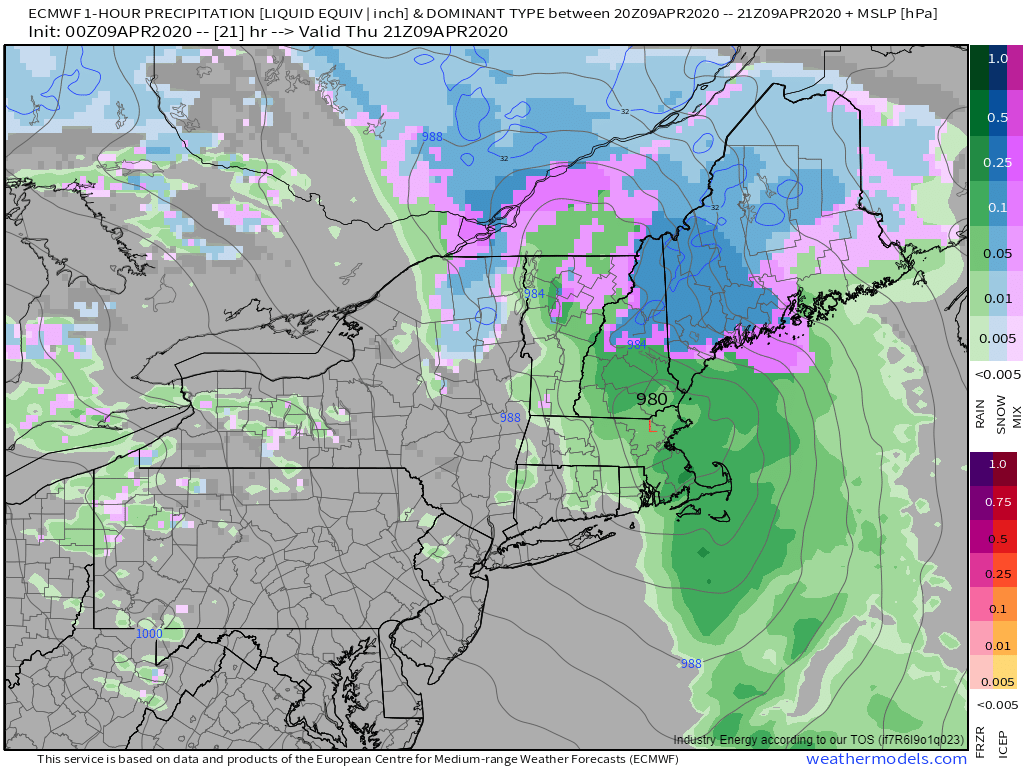
By 3 PM, heavier precipitation will begin arriving as the secondary low begins developing over MA/CT. This will fall as heavy snow in the mountains and heavy rain elsewhere. During this time, thunder is likely in southern NH as a the northern edge of a strong squall line moves through. Any severe weather associated with that line should remain confined to south of the MA border.
The secondary low will really begin to intensify as we move into the evening hours. As it does so, a combination of cooling due to intense upward motion, cooling due to the latent heat exchange that occurs when snowflakes melt, cold air advection on northeast winds, and cooling due to the sun going down will bring the rain/snow line back towards the coast. I think the ECMWF might be a bit optimistic about heavy snow falling in Freeport/Wiscasset/Rockland, but you won’t have to go very far north/west of those towns to get in on the action. While temperatures will remain above 32F outside the mountains, the intense dynamics associated with the rapidly intensifying storm will allow snowfall rates to push into 2-3″ per hour territory. When it’s snowing that hard, you’ll get accumulation even with surface temps 33-35F.
Heavy snow will continue into the evening as the secondary low rapidly intensifies just southeast of Portland. This map is valid at 8 PM and shows heavy snow continuing for most of Maine (save for the immediate coast east of 295 and south of Route 1 while precipitation comes to an end in New Hampshire. This mid/late evening window is when thundersnow becomes a distinct possibility across western Maine. It’s hard to exaggerate just how energetic this storm is going to be.
Mid/late evening is also the time when wind gusts will pick up along the coast east of Brunswick. Right ahead of the storm’s core, gusts over 50 mph are possible south of Route 1 where warmer temperatures will help strong winds aloft mix down to the surface. We’ll also have to worry about coastal impacts from spashover during high tide later this morning and tonight. No major coastal flooding is expected (thankfully the peak storm surge will occur right at low tide) but the typically vulnerable spots are likely to see some water.
The storm will wind down later tonight as the secondary low moves past Bangor towards Houlton. We’ll still be stuck under its influence tomorrow when upslope snow showers will try to move southeast in the form of squalls (possibly with thunder and hail) as a disturbance rotates around the storm. More on that this time tomorrow morning.
So how much snow are we going to end up with when this is all over?
For many of us, the answer is “a lot”. The base map here (shaded) is the NWS official forecast for snowfall totals today. I’ve penciled in my opinion with the contours. For the mountains, this is mostly a 12-18″ storm with locally higher totals in the typical favorite spots (Sugarloaf and the Whites above 2,000ft). That 12″+ zone will bleed east a bit into the foothills NW of Waterville. Most of the Bethel-Augusta-Belfast corridor should end up with 6-12″ (except for Belfast proper) with totals tapering off sharply south of that. The Fryeburg-Lewiston-Camden corridor is the most uncertain but I think 3-6″ is a decent bet. Should the storm end up pulling in a little more cold air, those areas are quickly headed for 6-12″. If the change to snow takes a little longer than expected, 2-3″ will be a struggle to pull off. Right now, based on current observational trends and high resolution guidance trends, I’m leaning a bit on the colder side but there’s still plenty of room for surprises. Farther south, I think the 1″ line makes it close to Gorham/Brunswick/Bath/Wiscasset/Rockland. Again, small forecast errors make a huge difference here. These towns could easily end up not seeing a single flake, or could wind up with a “surprise” 2-4″. Once you move south of Route 1, confidence in an all-rain event is much higher.