Hello everyone!
Today will feature the second part of the complex storm system that has been impacting the region since Sunday evening. A new area of low pressure formed offshore last night and is moving northeast into the Gulf of Maine this morning. Bands of heavy precipitation to the north and northwest of this low will impact the region today before the system moves into the Canadian Maritimes tonight.

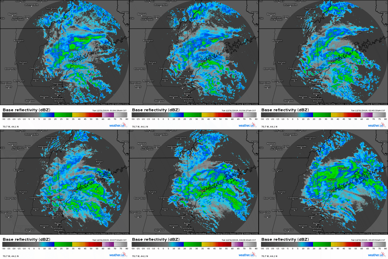
Radar imagery this morning does a good job highlighting the area of steadiest/heaviest precipitation along the Maine Coast and adjacent parts o f the foothills. The mountains are experiencing a bit of a lull in precipitation currently, but heavy snow will return there in the next couple hours.

Temperatures this morning are generally in the upper 20’s across most of the region, with the immediate coastline south of route 1 along the midcoast and east of the Turnpike/295 between Brunswick and Kittery reporting temps in the mid 30’s. Warm air should have a pretty hard time making it much farther west than it is now given that the low is passing to our east, which means winds across the area are generally from the north or northeast.

Here’s the latest NWS forecast for additional snow between 6 this morning and the end of the event. There’s still lots of snow yet to fall across the mountains and northeastern foothills with an additional 6-10″ likely to fall today and tonight. I suspect the snowfall gradient will be a bit sharper along the coast than currently advertised as the coastal front keeps a relatively sharp rain/snow line. Given relatively cooler air aloft, not too much in the way of sleet or freezing rain is expected though a brief period of mix is possible along the I-95 corridor where the coastal front might be a bit farther west at 2,000-4,000 feet than it is at the surface.
Rain, snow, and mixed precip will taper off this evening from SW to NE as the storm moves away. Temps will generally stay close to where they are now, in the mid 20’s for the mountains, upper 20’s for the foothills and most of the coastal plain, and mid/upper 30’s for the shoreline.

I’d like to end this post with a brief acknowledgement that yesterday’s forecast turned out absolutely terribly. Low level dry air was expected to halt the advance of precipitation around the NH/ME border, and given the dry air and lack of mid level dynamics, the precipitation that did fall was expected to be relatively light. Instead, a narrow band of heavy snow developed from Central NH to Cumberland County ME and dumped over 6″ of snow, when not more than 2-4″ was expected. I apologize for any inconvenience this error caused. I’ll take a closer retrospective look at this event when the dust (and snow) settles in a couple days and will publish my findings here.
-Jack

I don’t think anyone expected yesterday the way it happened. Plowing with the tractor this morning in South Freeport, even though we plowed yesterday. The weather is taunting us all. Thanks for the wisdom you share each morning. No apologies for not acing it yesterday needed.
You weren’t the only one to get the forecast wrong. I don’t think anyone called it.