
Hello everyone!
The winter of light snow events continues today as low pressure tracks through Ontario. Snow should begin falling in western parts of the area a little before noon and in eastern parts of the area a little after noon. Snow will initially be on the light/moderate side before becoming a bit heavier later in the afternoon/early in the evening.
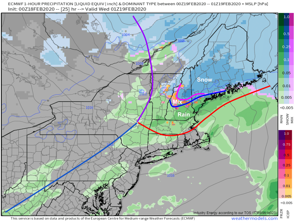
Because the system is moving off to our west, and there’s no high pressure system over New Brunswick to lock in the cold, a changeover to rain is expected at least in southern parts of the area. Southern NH and coastal York County ME likely end up with rain by around 4 PM before the above-freezing surface air advances to a roughly Lake Winnipeasaukee – Sebago Lake – Midcoast Route 1 line around 7-8 PM. I don’t think the surface warmth will make it much farther north than that, but some warm air aloft will support a mix of freezing rain and sleet after 6 PM or so in the foothills. The mountains should stay all snow.
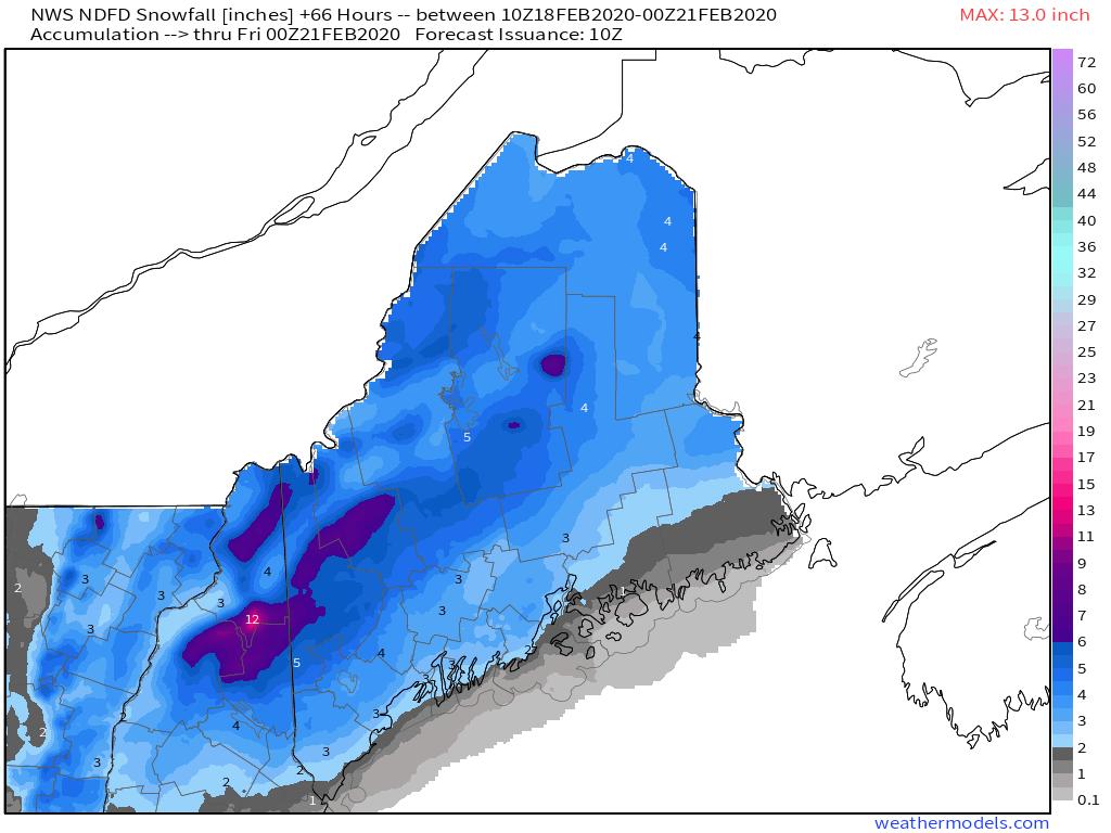
Here’s a look at how much snow our friends up at the NWS office in Gray (and, for northeastern Maine, Caribou) are expecting across the area today. As per usual, I might draw some of the contours slightly differently but those tweaks wouldn’t be significant. If you’re looking for >6″ of snow from this event, head up to the mountains. Most of the area will fall in the 3-6″ range while lower amounts are expected in southern NH and along the coastline (east of 95 south of Portland, south of Route 1 east of Brunswick) due to the expected changeover to rain.
Rain and snow will depart later tonight. High temps today will range from 25 up in the mountains to around 40 near Portsmouth NH.
-Jack
