
Hello everyone!
Today will feature classic hazy, hot, and humid weather as southwesterly flow kicks in across the region and some patchy morning fog burns off to clear skies by this afternoon. Aside from the immediate coastline north/east of Portland where winds will have a stronger southerly component, just about everyone will suffer from extreme heat today.
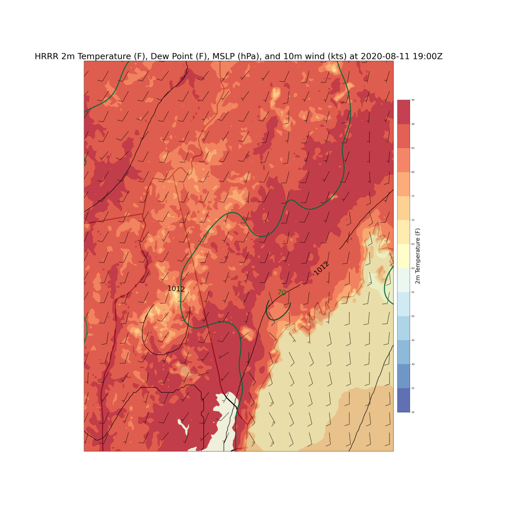
This forecast map shows expected temperatures, dew points, and winds at 3 PM. In case the colorbar is a little hard to read, spots in white will see actual temperatures over 95F while areas in the dark red will see temps in the low/mid 90s. That covers most of southern NH and much of interior ME. Slightly cooler temps, in the mid/upper 80s, will be found up in the mountains and along the coast. For nice weather, head on down to Penobscot Bay (ideally the southern edge) where temps should stay in the upper 60s or low 70s.
Also notice that the entire region will see dew points within a degree or two of the dreaded 70F mark which denotes extremely humid conditions. That means heat index values will head for 95F across much of the area outside the coastline. If you need to be outside today, especially during peak heating, take it easy and drink plenty of water!
The heat and humidity will, as per usual, support some afternoon pop-up showers and storms. These should be relatively few and far between because we don’t have anything to give the storms an initial upward push. The best shot at a brief storm will be up in the mountains, though one or two can’t be ruled out closer to the coastline.
-Jack
