Unsettled Weather Returns Today

Hello everyone!

A frontal boundary will be sagging south through the region today, and with it will come a bit of unsettled weather. Satellite imagery shows thick low/mid clouds across much of the northern half of our area (Hanover NH->Fryeburg->Camden roughly as of 5:30 AM) this morning, and radar imagery shows a couple rounds of showers embedded within those clouds. The general idea is that both the clouds and the precipitation associated with that front will sink towards the south as we head throughout the day today.

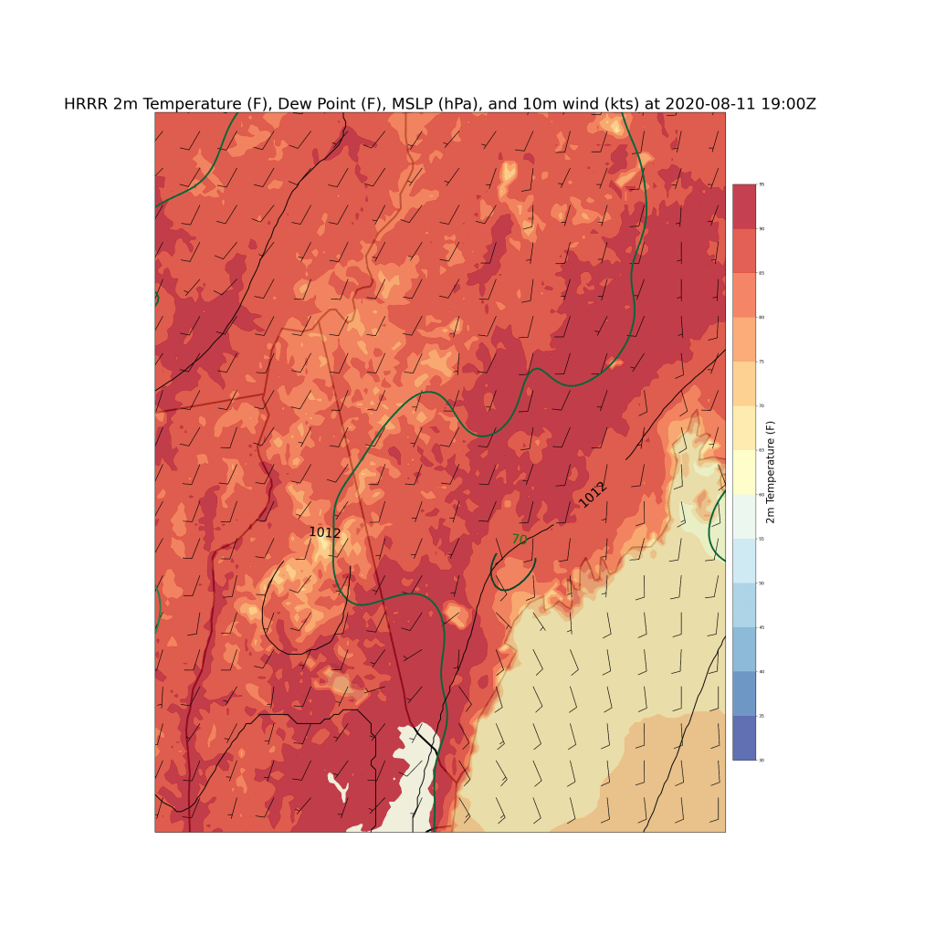
Thankfully for those of us in the south, that process will be fairly slow. Thus most of us south of Route 2 should see at least some sunshine this morning, even if low/mid clouds are present right at sunrise. That sunshine will combine with west-southwesterly flow to produce a warm and mildly humid airmass for southern parts of the area (outside the mountains). Look for highs in the mid/upper 80s over SW NH and interior SW parts of Maine. Cooler temps, in the upper 70s to low 80s, will be found along the Midcoast where flow will be more onshore.

Thankfully, dew points in the regions where warmer temperatures are expected will remain on the lower side (55-60). Up in the mountains, high temps will generally range from the mid 60s to low 70s depending on elevation and exactly how thick the clouds can stay.

Any time we get a cold front, warm temps, and a little bit of moisture to combine in the area, we have to start thinking about thunderstorms. Today will be no exception. Expect showers and storms not already ongoing this morning to pop up west/northwest of our area around lunchtime before cruising east/southeast during the afternoon and arriving along the coastline by late afternoon/early evening.

Storm coverage will be scattered so there’s no guarantee you’ll see a storm, but if you do, expect heavy rain, lightning, and the potential for some gusty winds. Storms will be moving fast today so if you happen to be outside when they arrive, just head inside for a few minutes while the storm passes and clear skies should return soon after.

-Jack

Sunnier and Drier But Still Nice and Cool Today

Hello everyone!

Today will feature continued cool temperatures, low humidity, and widespread sunshine as we enjoy the center of a beautiful Canadian airmass. For this time of year, the weather doesn’t get much better! Yesterday, we saw shower coverage that was probably a little above what I anticipated because we had a subtle disturbance embedded within northwesterly flow aloft. Today, we shouldn’t have that problem so shower coverage should return to the regularly-scheduled “widely scattered” with most towns staying dry. Our cool and dry air near the surface will also help prevent the development of too much convection this afternoon.

High temps today look very similar to yesterday, ranging from the upper 60s up north to upper 70s south.

-Jack

Fantastic Late-Summer Weather Today

Hello everyone!

Today will feature what I consider to be the best possible weather conditions for this time of year as cooler and drier air arrives from the northwest. Skies will be partly to mostly sunny with just a few mid/high clouds drifting through on the north edge of a weak low pressure system over Virginia. Temps will be pleasantly cool (for this time of year), ranging from the upper 60s north to the upper 70s along the coastal plain. Dew points will linger in the upper 40s to low 50s. Pretty hard to beat that until our first big September cold front.

There may be a brief shower this afternoon in the mountains or down in southern NH but overall, it will be another dry day.

-Jack

Clearing Skies and Continued Pleasant Temperatures Today

Hello everyone!

Today will feature a trend towards more sunshine as clouds and showers associated with a cold front slide offshore in the next couple hours. Most of the rain associated with this system is now moving east of Penobscot Bay, but a few more showers are noted on radar imagery over the foothills of western Maine and the CT River valley. These will slide east over the next few hours and should be long gone by mid/late-morning. Sunshine is already crossing into western Vermont and should arrive by lunchtime.

The afternoon will feature westerly breezes bringing cooler and drier air into the region. Western and northern parts of the area will see this process occur much faster, so there won’t be enough moisture left over for a pop-up afternoon shower. The same can’t be said for much of the coastal plain where lingering moisture will combine with the developing sunshine to produce a bit of instability. This should be enough for a couple of pop-up showers, but not much more. Most of us will remain dry.

High temps today will range from the low 70s up north and along the Midcoast to near 80 in southeastern NH and adjacent SW ME.

-Jack

Cool Weather Continues Today

Hello everyone!

Today will feature continued cool weather and a few more clouds than we’re used to as an ocean storm develops off the Virginia Capes. This system will pass well to our south today, so clouds over southern areas is about all we’ll get from it. While I can’t entirely rule out a brief shower over far southern NH, I think the much safer bet is for dry weather to prevail across the area once again. The other spot where a shower can’t totally be ruled out is in the foothills/mountains north of Augusta/Waterville. Skies will get sunnier as you head farther north, so there will be a small bit of instability available this afternoon. Not enough to worry about storms, but enough to hold open the possibility for a brief shower.

Temps will range from the low 70s right along the coast to the upper 70s in the CT Valley and the hills north of Augusta.

I’ll be gone on another brief trip tomorrow morning, so won’t have a forecast update. The forecast for tomorrow looks a bit warmer as winds shift around to the south/southwest ahead of an approaching cold front. Highs will range from the mid 70s along the coast and up north to the mid 80s in the usual warm corridor of Waterville/Augusta/Lewiston
/Fryeburg/Manchester/Keene. Skies should be mostly sunny except for afternoon clouds that pop up especially over NH and the mountains of western ME. Some of those clouds will grow into showers and storms, but they likely won’t have access to enough instability or upper-level wind to become severe outside of a stray wind gust.

-Jack

Significantly Cooler Today

Hello everyone!

I’m delighted to say that today will bring substantially cooler weather to our area as northeasterly winds on the back side of Tropical Storm Kyle drag cooler air into the region from New Brunswick. That same northeasterly breeze has brought a layer of low clouds into the region this morning. It’s not immediately clear how quickly these might break up, but I suspect by lunchtime most of us will have at least seen a glimpse of sunshine. As we move into the afternoon, some more daytime heating-driven clouds will pop up but only one or two of these over the higher terrain and northeastern parts of the area looks to be capable of producing a few raindrops.

High temps today will range from a little above 80 in northeastern areas as well as along the CT River to the low/mid 70s along the coastline and in the mountains.

-Jack

Much Nicer Weather Today

Hello everyone!

Today will feature much nicer weather as cool air filters in from Canada on light NW breezes. High temps will be a bit cooler than recent days, especially up in the mountains, but even where warmth remains, the continued dry air will be quite welcome. Look for highs ranging from the low/mid 70s up in the mountains to the mid 80s along the interior coastal plain. As per usual, the immediate coastline will be a few degrees cooler thanks to an afternoon sea breeze. Today’s skies will look a lot like yesterday’s as high clouds drift through from the west. As with yesterday, most of us will consider the day to be “mostly sunny” even though there won’t be blue sky in all directions. As far as precipitation goes, there will only be a slim chance of a shower over far SW NH this afternoon. Otherwise, dry weather continues.

-Jack

Still Hot But Less Humid Today

Hello everyone!

Today will feature continued warm weather and a welcome reprieve from the recent extreme humidity. Satellite imagery shows mostly clear skies across the region this morning with a few cirrus lurking back to our west/southwest. These high clouds will drift overhead from time to time today, especially in southern regions, but they won’t block much sunlight so most of us will probably think of today as “mostly sunny”.

That sunshine will work together with warm air aloft and a pinch of downsloping (remnant NW breeze this morning) to produce another day of hot temps. Most of the region will top out within a few degrees of 90. Low/mid 80s will be found right along the immediate coastline and farther north in the mountains. Dew points will take a welcome dive into the low/mid 50s (!) for all but the immediate shoreline this afternoon.

With such dry air, we don’t need to worry about any showers or thunderstorms today.

-Jack

Heat Continues Today, Humidity Subsides A Bit

Hello everyone!

Hot weather will continue today as south-southwesterly winds shift around to the west-northwest. Thankfully, this means that humidity will slowly subside as we head through the afternoon, especially for those up in the mountains. With offshore flow, mostly sunny skies, and a bit of downsloping, we’ll see warmth continue, and perhaps expand a bit towards the shorelines. With that in mind, look for high temps ranging from the low 80s north to low/mid 90s south. A few spots along the Midcoast could hold onto some onshore breezes which would keep temps a bit cooler (upper 70s/low 80s).

As the drier air arrives, a few showers can’t be ruled out this morning up in the mountains/foothills and midday closer to the coastline. Most of us won’t see any rain, and those that do won’t have to deal with it for long. I wouldn’t be shocked to see one or two of the afternoon showers along the coast get tall enough to produce a rumble or two of thunder, but no severe weather is expected.

-Jack

Very Hot and Humid Today

Hello everyone!

Today will feature classic hazy, hot, and humid weather as southwesterly flow kicks in across the region and some patchy morning fog burns off to clear skies by this afternoon. Aside from the immediate coastline north/east of Portland where winds will have a stronger southerly component, just about everyone will suffer from extreme heat today.

This forecast map shows expected temperatures, dew points, and winds at 3 PM. In case the colorbar is a little hard to read, spots in white will see actual temperatures over 95F while areas in the dark red will see temps in the low/mid 90s. That covers most of southern NH and much of interior ME. Slightly cooler temps, in the mid/upper 80s, will be found up in the mountains and along the coast. For nice weather, head on down to Penobscot Bay (ideally the southern edge) where temps should stay in the upper 60s or low 70s.

Also notice that the entire region will see dew points within a degree or two of the dreaded 70F mark which denotes extremely humid conditions. That means heat index values will head for 95F across much of the area outside the coastline. If you need to be outside today, especially during peak heating, take it easy and drink plenty of water!

The heat and humidity will, as per usual, support some afternoon pop-up showers and storms. These should be relatively few and far between because we don’t have anything to give the storms an initial upward push. The best shot at a brief storm will be up in the mountains, though one or two can’t be ruled out closer to the coastline.

-Jack