
Hello everyone!
Maine and New Hampshire appear to have been put on the storm-every-two-days plan by Mother Nature to make back the snowfall deficits we opened up during our dry January. After snow Tuesday/Wednesday and Friday of this past week, we’re getting our day off today before flakes fly once again tomorrow.
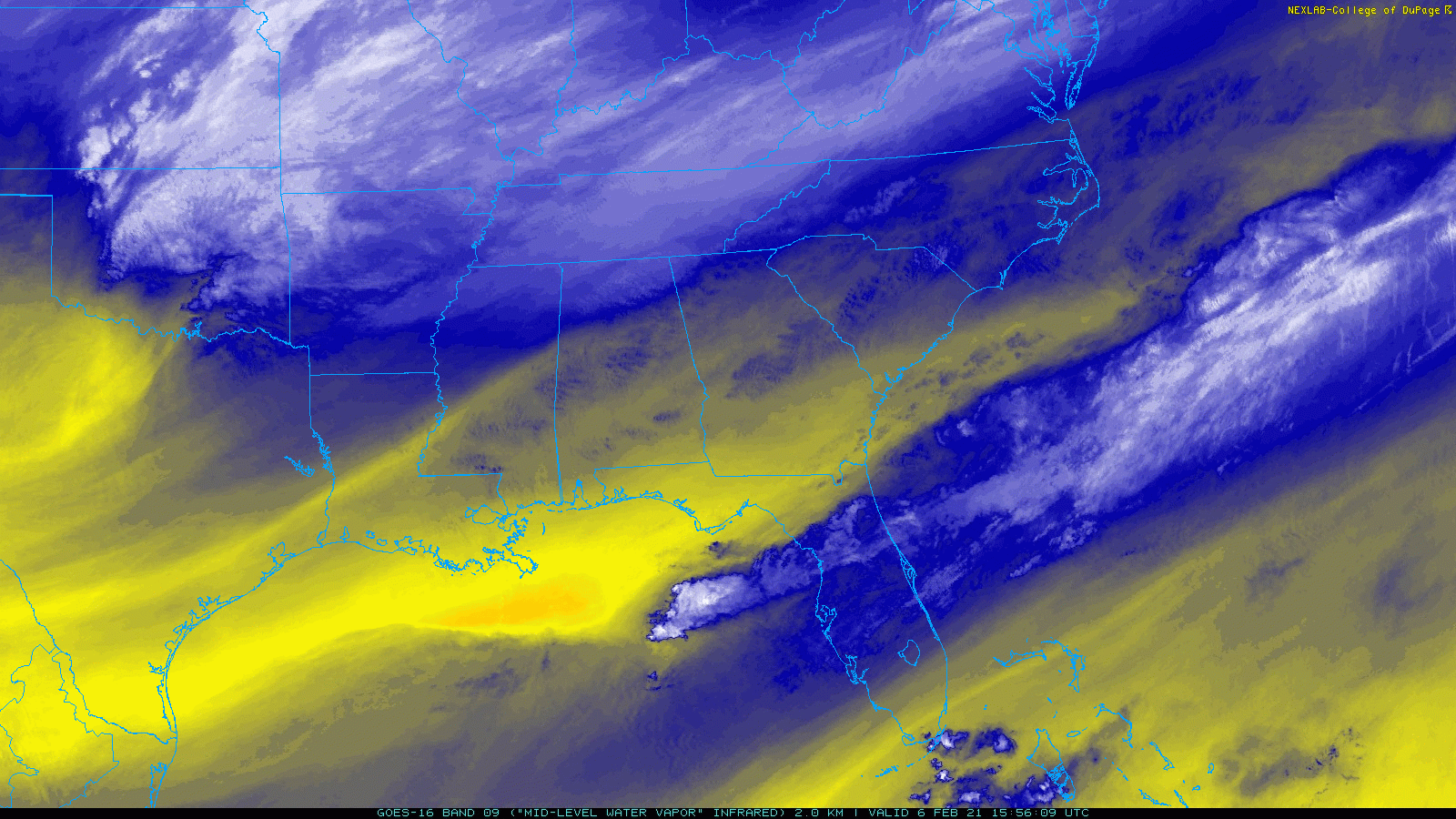
Tomorrow’s storm system is currently beginning its journey over the Southeastern states before it heads up the coast starting later tonight. The swirl over Oklahoma will become our primary storm system, and it will be steered in part by the thunderstorms visible over the Gulf of Mexico, Gulf Stream, and interior parts of AL/GA. Thunderstorms appear as blue/white speckles in the loop above.
These thunderstorms are a double-edged sword for our snowfall forecast. On the one hand, they can steer the storm farther northwest (closer to us) by releasing heat into the upper atmosphere as water vapor condenses and freezes. This would help push snowfall totals up a bit in our area. On the flip side, if too much water vapor condenses and freezes in these thunderstorms to our south, there will be less left over to move north and condense/freeze over our area tomorrow.
Whatever snow does make it up this way will arrive from southwest to northeast during the mid to late morning hours tomorrow.

While forecast model guidance continues to portray slightly different solutions in terms of how close the storm might track, I think the image above does a pretty good job highlighting what to expect tomorrow evening when the system will make its closest approach. Snow should overspread the whole area, though it will be rather light as you move closer to the mountains. Closer to the coast, moderate snow is expected with periods of heavy snow possible depending on exactly how mesoscale banding sets up.
Unlike our last system, this will be quite the fast-mover. While snow begins late morning or early afternoon for most, it will be all wrapped up by the fourth quarter of the big game.
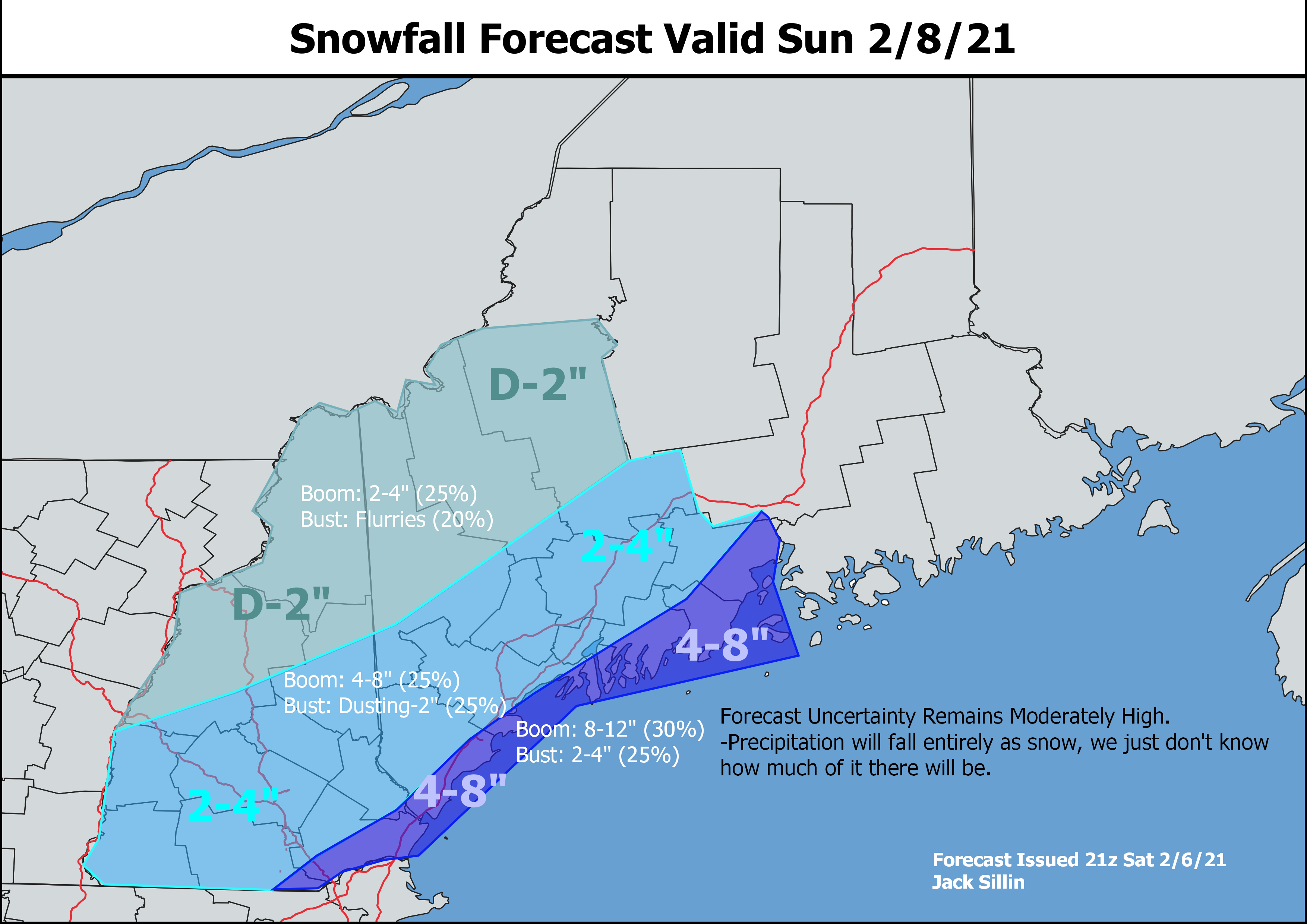
Here’s a look at how much snow I’m expecting at the moment. While there aren’t any concerns with mixing this time around, there are concerns regarding how much precipitation actually makes it up our way. The highest totals will be found along and near the coast where 4-8″ is likely. I suspect we’ll probably see more 4-5″ reports than 7-8″ reports, but with the potential for mesoscale banding to significantly enhance snowfall rates, I thought it best to leave the door open on higher totals. This is also why the “boom” probabilities are relatively higher for this area. As we learned back in December, it doesn’t take that much of an adjustment in the location of a mesoscale snow band to produce significant adjustments in snowfall totals.
Snow totals will drop off as you head towards the mountains with the obvious caveat being west/northwest-facing slopes which should cash in on some substantial upsloping as colder air pours in behind the system tomorrow night.
-Jack
