
Hello everyone!
A messy winter storm will begin impacting the region later today, and will bring with it the full range of precipitation types including rain, snow, and everything in between. The precipitation won’t begin until the early/mid afternoon hours, however, so we’ll have several dry/overcast hours this morning before we need to worry about frozen precip and slick roads.
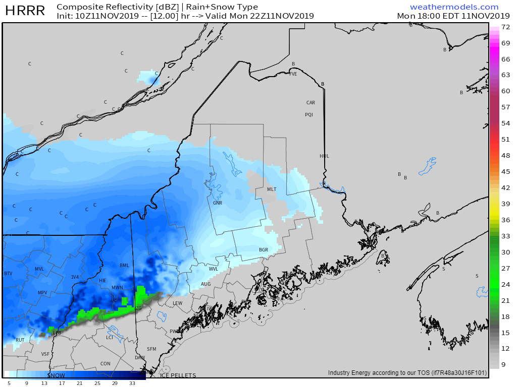
By 5PM, snow will be falling across most of the area’s northwestern half as the mid-level warm front associated with this system moves north. If you’re north of a roughly Lebanon NH-Lewiston-Belfast line, you can expect a period of snow this afternoon amounting to between a coating and 2″ with the highest totals in the northern mountains.
Steadier precip will develop later this evening as low pressure tries to intensify over the Ohio Valley. With warm air surging northward in the mid levels, expect a swift changeover from snow to sleet and freezing rain, especially SE of the mountains. Some model guidance insists that above-freezing air will arrive at the surface, changing precip over to rain, but this setup is ripe for cold air damming so outside of far SE NH and some of the Midcoast peninsulas, I expect temps to remain below freezing during this event.
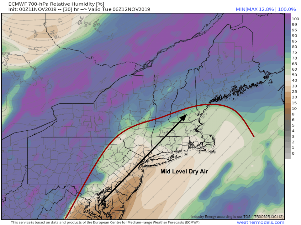
Later tonight, mid level dry air will race into the region ahead of the storm which will be moving through PA/NY. This means that we won’t be able to produce ice crystals in the clouds, so even if it were cold enough for snow, the flakes couldn’t form. As a result, everyone not within ~30 miles of the Canadian Border will go over to freezing drizzle (distinct, believe it or not, from freezing rain!) for several hours. While ice accretion will likely remain below the threshold for power outage impacts, this freezing drizzle will add a very slippery layer to sidewalks and roads before the Tuesday morning commute.
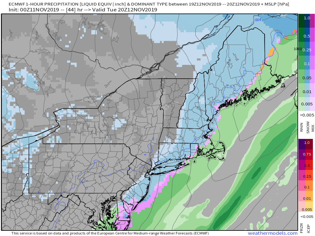
During the day tomorrow, we’ll see the back side of the storm move through. NW winds will rapidly bring colder air back into the region at all levels of the atmosphere, so a burst of moderate snow is likely. The snow falling on top of tonight’s ice layer will create very slick travel conditions for the PM commute.
Overall, most of the region won’t see appreciable snow accumulation >2″, with the exception being the far NW mountains where over 6″ is possible.
I’ll have more info on tomorrow’s half of the storm tomorrow morning.
-Jack
