
Hello everyone!
Yesterday’s storm system has now moved NE into the Canadian Maritimes, but unfortunately another system is right on its heels. That storm will move through the region today with a mix of rain and snow. The best chance for accumulating snow will be in the higher elevations of the Whites and adjacent parts of the Maine mountains where 2-4″ will likely pile up. Snowflakes will likely fall for a brief time this afternoon in the valleys as well as the foothills, but accumulations more than a dusting are far less likely in these areas.
Perhaps unsurprisingly, this system means that the entire region is in for another day of overcast today. High temps will range from 32 in the north to 40 in southern NH.
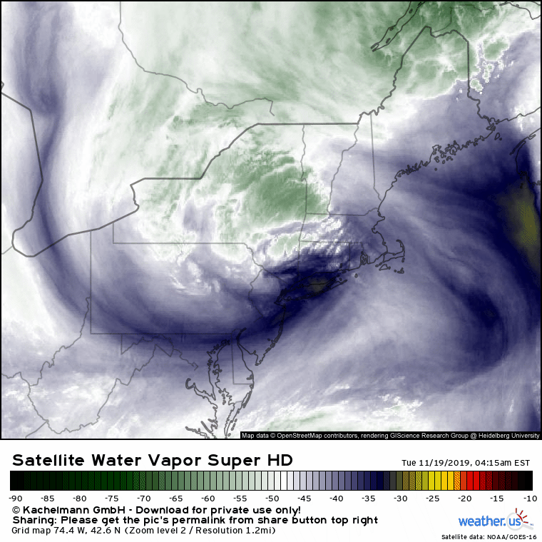
While this storm means we have to deal with another day of dreary weather, it does look pretty neat on satellite imagery. Our last storm can be seen in the far top right of the image, while the northern edge of a third storm can be seen at the very bottom of the image. That system will exit “wide right” (i.e. far out to sea) tomorrow, bringing more clouds but minimal precipitation.
-Jack
