Today has gotten off to a cold and clear start as high pressure crests overhead. As that high drifts offshore later today, we’ll continue with our familiar routine of increasing clouds due to warm air advection on light SW winds. Those clouds are already advancing through NY into VT/MA, but guidance suggests they may get hung up a bit this morning as a little mid-level disturbance passes through and shifts winds briefly towards the W/WNW instead of W/WSW. In any case, by this afternoon, clouds can be expected across most of the area so enjoy the sun while it lasts this morning.
Temps will rebound from seasonably cold lows last night (yes, these temps are normal for early February) to fairly average values by this afternoon. Expect high temps to range from the upper 10’s in the north to the mid 30’s in SE NH. The system approaching from the west won’t bring any precip to the area until early tomorrow morning when some light snow is expected.
Today will feature chillier weather as a cold airmass moves in behind yesterday’s storm. Several of you were kind enough to drop your barometric pressure readings in the comments of yesterday’s post which confirmed that we were indeed dealing with a very strong storm. For those not familiar, winds are caused by horizontal differences in barometric pressure. The greater the pressure changes over some given distance, the stronger the winds will be. Since that very deep area of low pressure is now moving into the Canadian Maritimes, we have a relatively strong pressure gradient across the area this morning.
As a result, gusty NW winds are expected across the area today. These winds shouldn’t be strong enough to cause many power issues, but given that some trees and lines are still covered in snow and ice from yesterday’s storm, a few scattered outages can’t be ruled out.
With breezy NW winds, you already know what the clouds/precip part of the forecast looks like. Upsloping will bring clouds and flurries to the mountains (especially this morning) while the coastal plain should clear to sun relatively quickly. High temps will range from 10 in the north to 25 in the south.
Round two of our multi-part storm system will arrive today as a strong area of low pressure moves up the Appalachians. This system’s heavy precipitation will be split into two areas: one NW of the low’s track (associated with frontogenesis) and another SE of the low’s track (associated with convection). Because the low will track directly overhead, most of our area will experience light/moderate precipitation today. The exception will be up in the mountains where the strong forcing associated with frontogenesis will arrive later this afternoon.
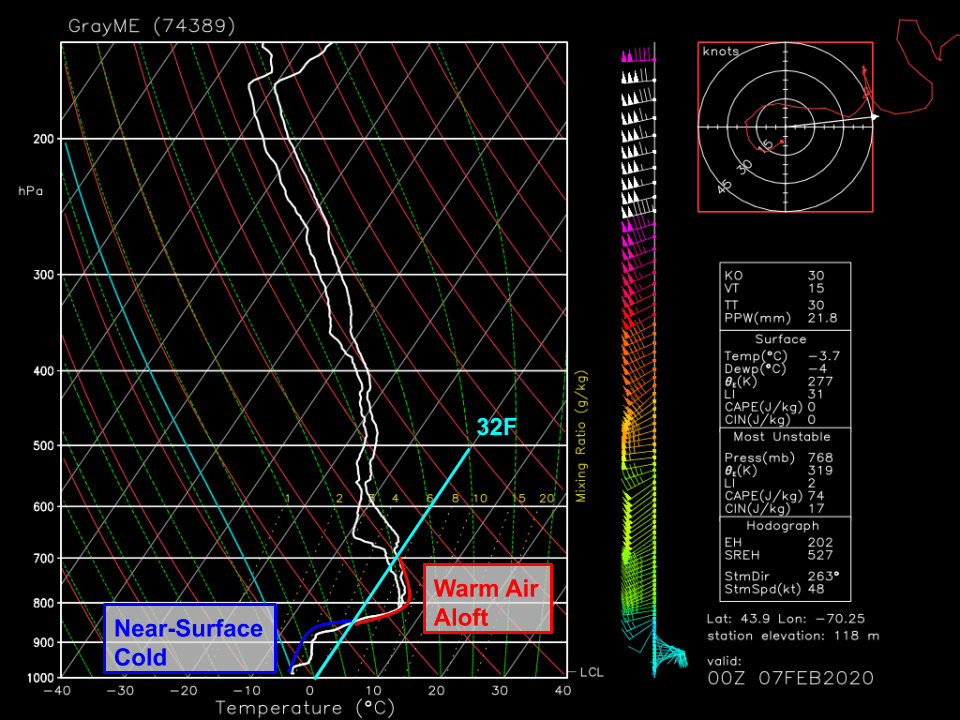
As far as precipitation type goes, here’s a look at how the temperature changed with height above Gray ME around 7 PM yesterday. A pronounced warm layer is noted between 3,000 and 10,000 feet above the surface while the air below that is below freezing. That warm layer is melting any snowflakes that fall from the clouds higher aloft. This rain then refreezes as it re-enters the near-surface cold layer. If it has enough time to fully refreeze, it falls as sleet. If it doesn’t have enough time to fully refreeze, it will freeze on contact with cold surfaces (freezing rain).
A quick look at surface observations this morning suggest that most of the area is experiencing freezing rain with a bit of sleet farther north where that cold layer is a bit deeper.
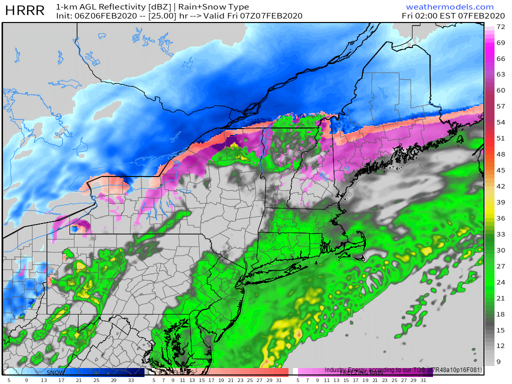
This morning’s light freezing rain (and northern sleet) will continue until around 1-2 PM (the stop time of the loop above). At that point, the storm center will begin entering our area from the southwest. As the low passes through, winds will switch around to the north/northwest and the warm layer we have in place this morning will quickly cool below freezing.
Mixed precip will change back over to snow as this cooling occurs. While snow will be quite heavy, this storm is racing NE so fast that meaningful accumulations aren’t expected outside the mountains. That said, don’t be shocked if you run into a brief period of low visibility if you’re out and about this evening.
Here’s how much snow the NWS is expecting from this system today. I might have drawn a couple contours slightly differently, but overall my thinking is very much in line with theirs. If you’re looking for significant snow today, head north of Route 2.
As far as ice accumulations go, here’s what the NWS is thinking. Most spots along the coastal plain (away from the shoreline) and in Central NH should end up with around 1/3″ of ice by the time all is said and done. That’s not quite enough to cause major power outage issues, but it will certainly make untreated surface suitable for ice skates.
While this post is already unusually long, I wanted to end with a quick note about just how strong this storm will become as it moves up the Maine coast.
The strength of storms is typically measured by a system’s minimum central sea-level pressure. The lower the pressure, the stronger the storm. This system will challenge record low sea-level pressure values for February as it moves through CT/MA during the midday hours. The storm will be even stronger as it moves up the Maine coast, but our records are lower. That said, to get within a few mb of record low SLP values is pretty impressive.
For anyone with an analog barometer at home, it’d be worth taking a peek this evening. We don’t see values like this very often! As a final note, if you have a rotating-drum barometer that’s functional, please drop a picture of your data in the comments tonight or tomorrow morning. Model guidance has been producing some gravity wave features that myself and several meteorologists are very curious to see in the real atmosphere (if they exist).
Today will feature the arrival of our next winter storm which will bring a prolonged period of snow, sleet, ice, and rain today and tomorrow.
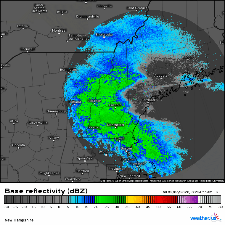
Radar imagery shows steady precip ongoing across the area this morning. From what I can tell, this is falling as snow across the entire area and generally falls under the “moderate snow” category. This round of snow will be relatively short-lived (notice the drier air already working into western NH) as the weak lead disturbance responsible for producing the snow moves quickly east. Most spots should end up with 2-4″ of snow by the time precip tapers off mid/late morning.
Early this afternoon, expect little organized precipitation as we sit between the first wave (departing into Canada) and the second (still developing well to our south). Low level moisture may produce some freezing drizzle, but aside from slick untreated surfaces, impacts during this time should be relatively minimal.
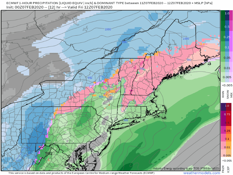
Round two of this storm will arrive in the early morning hours tomorrow as steady precip returns. That round of precip will likely fall as sleet/snow up north, rain in southern NH/coastal SW ME, and freezing rain for everywhere in between. While a significant ice storm isn’t expected, a few spots in central NH/interior SW ME could see between 1/4 and 1/3″ of ice accretion. That’s generally not enough for major power disruptions, but scattered outages can’t be ruled out.
I’ll have more info on tomorrow’s half of the system tomorrow morning.
High temps today will range from 25 in the mountains/foothills to around 40 along the NH Seacoast.
A cold front pushed through the region last night, and cooler air has begun moving into the region as a result. That process will continue through the day today before the next wave of low pressure and associated push of warm air approaches tomorrow. Expect temps to range from around 20 in the mountains to around 35 in southern NH. That’ll feel relatively chilly, but believe it or not, the entire region will be within around 5 degrees of climatological norms by this afternoon. A light NW breeze will also contribute to the feeling that this airmass is colder than it actually is.
Satellite imagery shows some clearing in northern and central parts of the area this morning as dry air begins to work in from Canada. The thicker cloud deck present over southern areas will be tough to erode today, but most spots should at least get some breaks of sunshine today. The north will stay sunniest for the longest, while the NH/MA border has the best shot of remaining cloudy all day.
Our next round of precipitation will arrive in the form of snow and mixed precipitation tomorrow.
Today will feature the slow approach of a cold front, which means another day of light SW breezes and mild temperatures. Highs will range from around 30 in the north to around 45 in southern NH. Satellite imagery this morning shows high cirrus clouds spreading across the entire area, with a thicker mid level cloud deck advancing through central NH into SW ME. Generally, most of the area will experience mostly cloudy conditions today though some breaks of sun are possible especially as you head farther northeast.
A weak wave of low pressure will develop along the front this afternoon as it passes through the region. This will bring a period of light snow to the mountains and possibly the foothills north of route 2 between around noon and around 4 PM. Accumulations of up to an inch are possible in most spots, with 1-2″ in the higher terrain. While a few flakes or raindrops could fall farther south, they’ll barely be noticeable.
Several rounds of more substantial rain/ice/sleet/snow are expected later in the week.
Today will feature another day of mild temps and generally quiet weather as we remain stuck in a mild zonal flow pattern with no cold air in sight. Expect high temps to range from around 32 in the north to around 45 along the NH Seacoast. Skies today will feature a mix of sun and clouds with a few more clouds than sun up in the mountains and a bit more sun than clouds down along the coastline. Enjoy the quiet weather during the first half of this week, a messy winter storm looks to begin impacting the region Wednesday/Thursday and may linger into the weekend.
As a powerful ocean storm heads off into the Atlantic, too far east to bring us any serious impacts, and another clipper system dives into PA/NY, we’ll be stuck between two storm systems today. That means we can expect lots of clouds, little in the way of precipitation, and relatively mild temps. Highs will range from the upper 20’s in the north to the upper 30’s along the coast. While mainly dry weather is expected, a few snow showers can’t be ruled out especially in the mountains and along southern parts of the coastline. No accumulation is expected.
Today will feature mild and unsettled weather as a series of upper level disturbances zip near or through the area. The first of these disturbances is producing some light snow across the region this morning. We have maybe another hour or two before those flurries dissipate. No accumulation is expected. Clouds will stick around for the rest of the day while another flurry or two is possible with the next disturbance this evening. Temps will remain on the warmer side today, ranging from 30 in the north to 40 in the south.