
Hello everyone!
Today will feature another day of warm and humid weather for most of the area as we remain on the wrong side of a frontal boundary over the Plains. Expect high temps to reach the low/mid 90s once again in southern NH as well as some parts of interior Maine. The mountains will also remain warm with highs in the mid/upper 80s. Meanwhile, the coast will get a welcome reprieve from the worst of the heat as a backdoor cold front slips west.
That front is showing up well in current observations this morning as Rockland is reporting a temperature of 58 while Portland sits at 71 and Portsmouth NH is already up to 77.

Also note the cooler temps inland over northern and eastern Maine (64 in Bangor and 63 in Millinocket which both saw temps above 80 this time yesterday).
The impacts of this front on our weather for later today are evident when looking at forecasts for 2m temperature (shaded in the map below) and winds (the little barbs in the map below).

Note the onshore flow (winds blow towards the end of the long side of the barbs, so those over Maine with the long side oriented NW/SE indicate winds blowing from SE to NW) over Maine bringing cooler temps (70s) inland later this afternoon. Unfortunately, there will still be plenty of humidity to go around (dew points over 65 indicate really sticky air). The cooler air and high humidity will combine to produce conditions favorable for fog formation.

Satellite imagery confirms this idea and shows a thick fog bank drifting southwest behind the front. I suspect that this fog bank’s advance will be slowed by daytime heating for most of today but fog will likely continue moving west this evening. Parts of the Midcoast (especially the tips of the peninsulas) may remain under fog and/or stratus (low clouds that do not reach the ground) for most if not all of today.
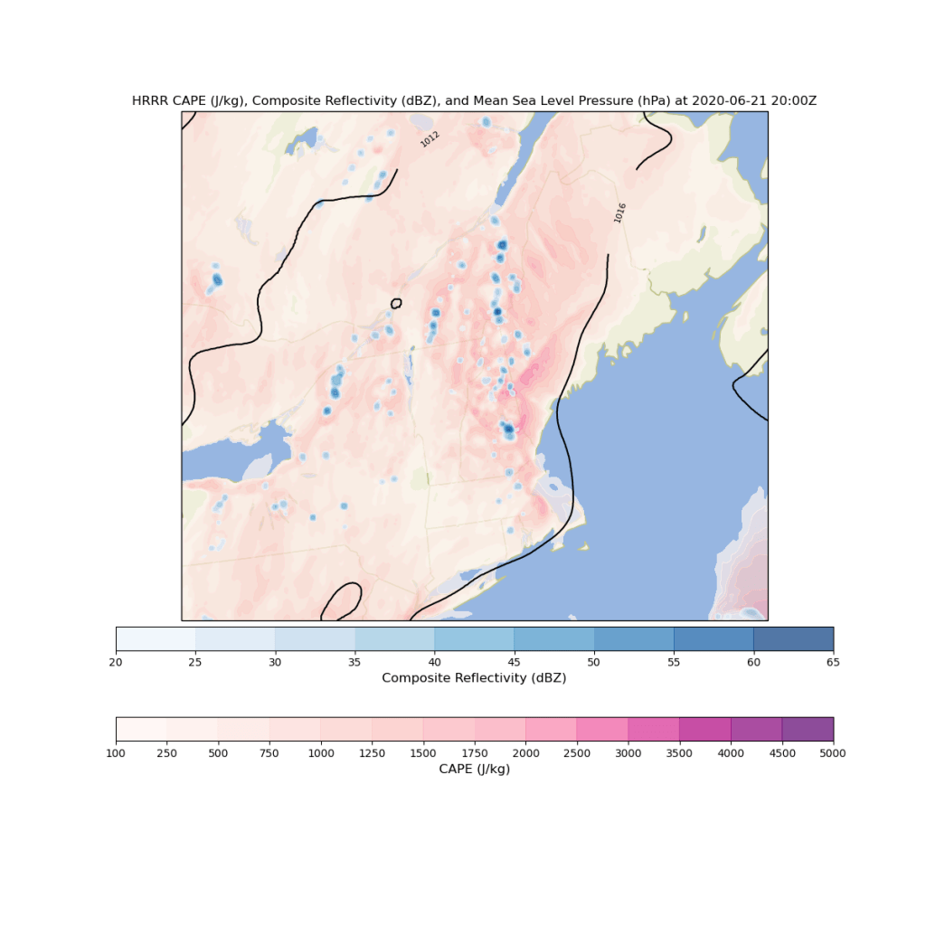
Much like yesterday, our warm and humid airmass will support afternoon showers and thunderstorms especially in the mountains and NH, both of which will be on the warm side of our backdoor cold front. That front should prohibit much if any storm development in coastal or interior Maine (the exception being the far northern mountains). Just like yesterday, there will not be enough upper-level wind to be concerned about severe weather with these storms. That said, heavy rain and lightning can still be dangerous especially if you’re outside when storms arrive.
-Jack
