Hello everyone!
If you somehow managed to enjoy yesterday’s steambath airmass, well I have good news for you. It’s gonna be just as boiling today.

Hyperlocal temperature data (a very neat new addition to weather.us) shows temps already approaching climatological highs for the day (as of 5 AM). That’s one easy way to tell that today’s going to be really lot. The Jetport has yet to drop below 80 degrees! More acceptable temps (<70) are found in the Midcoast and up in the mountains.
High temps today will once again soar above 90 for most of the area outside the Midcoast shorelines and the far northern mountains. Some spots in southern NH could make another run at 95.

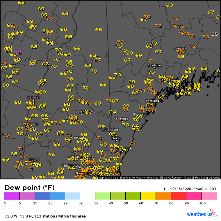
The hyperlocal dew point map this morning shows widespread values within a few degrees of 70F. That’s actually down a tad from yesterday, and is consistent with the more moisture-rich air associated with the warm front we saw yesterday drifting north. Nevertheless, dew points near 70 still feel pretty terrible even if they’re marginally less so relative to dew points near 75.
This humidity, combined with the extreme heat discussed above, will push heat index values into dangerous territory (>95F) once again today. Limit outdoor activity during the heat of the day if you can and make sure to stay hydrated regardless.

Given all this heat and humidity, as well as an approaching cold front, we’ll have to think about showers and thunderstorms today. High-resolution guidance isn’t super impressed by this afternoon’s storm threat, but some of the cells that approach the coastline early in the afternoon could be quite strong given how much juice they have to work with. Threats from storms today include damaging winds, frequent lightning, and heavy rain.
Storms will develop in the mountains later this morning before moving towards the coastline during the early/mid afternoon. Storms should be all wrapped up by mid/late afternoon.
-Jack
