
Hello everyone!
After a few fairly quiet days, we’ll be watching out for showers and thunderstorms today as a cold front drops into the region from the northwest.
This morning, we’ll start out with fairly abundant cloud cover ahead of and along a warm front pushing through the area from the southwest. A few stations in southern parts of the area are reporting patchy fog in the wake of last night’s showers. The general trend should be towards sunnier skies by mid/late morning especially across southern and southwestern parts of the area.
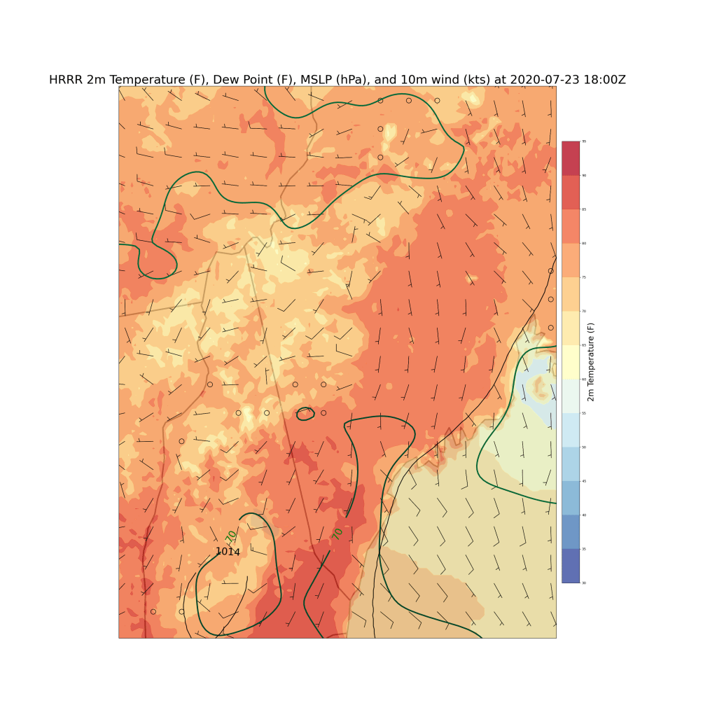
That sunshine will push temps into the upper 70s or low 80s across most of the region except for the mountains and immediate coastline. South-southwesterly breezes will bring humidity back up to unpleasant levels (dew points in the high 60s/low 70s). As we all well know by this point in the season, a cold front plus heat plus humidity is a recipe for strong thunderstorms.
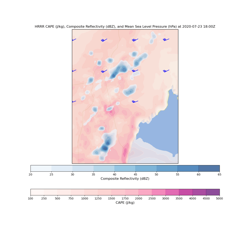
Thunderstorms will be developing over the mountains beginning around noon before moving east.

Today’s most intense storms will occur in the mid-afternoon hours over southern and central parts of the region (generally west of I-95 and south of Rt 2). These storms will pack quite the punch if we get enough sunshine this morning to produce robust instability. Damaging winds, heavy rain, and frequent lightning will be the primary threats, but some small hail is possible too. I can’t even totally rule out a brief tornado in the Sebago Lake region which is notorious for giving rotating storms a last push across the finish line.
Showers and storms will fade and move offshore by sunset.
-Jack
