Today will feature the arrival of hotter temperatures and higher humidity as winds shift around to the southwest. Before we get to either the heat or humidity this afternoon, we’ll have to finish burning off some fog that’s present over eastern parts of the area this morning. That process should be complete for all except the Midcoast peninsulas by mid/late morning. Once we’re done with the fog, expect mostly sunny skies for the rest of the day.
High temps will range from the upper 70s in the mountains and right along the shoreline to the low 90s in southern NH. A few showers will pop up this afternoon over far northeastern parts of the area, but otherwise we’ll stay mostly dry.
Thick cloud cover has rolled into the region this morning ahead of a cold front in the Saint Lawrence Valley. As that front slides east, it will bring a few rounds of showers to the region today. The first and perhaps most widespread round of showers is in progress currently across the mountains. Because we have so much cloud cover this morning, there won’t be enough instability for these showers to produce much more than some rain and possibly a brief rumble of thunder.
As the front drifts through this afternoon, showers will become more isolated and skies will begin to brighten especially in NH and western parts of Maine. Southerly onshore flow and plenty of clouds/showers will keep temps on the cooler side today. Highs will range from the low/mid 60s in much of Maine to low/mid 70s in much of NH.
Heat and humidity will return with a vengeance this weekend.
Today will feature another round of pleasant weather as high pressure drifts lazily over our area. Morning stratus and fog will burn off over the next couple hours, and skies will be mostly clear except for a few cirrus spilling over the top of the ridge from the west. Winds will generally be light out of the southeast today which will keep temps in the low/mid 70s for most of the area (a few low 80s in western NH). Thankfully, dew points will also remain on the lower side (mid/upper 50s). Aside from the possibility of a brief shower in NH this afternoon/evening, we’ll be mostly dry today.
Enjoy the nice weather while it lasts! Heat and humidity returns this weekend.
In the wake of the system that brought considerable storminess to the region yesterday, we’ll enjoy comfortable weather today as northeasterly winds bring cooler and drier air into the region from Canada. Now that we’ve moved into mid-summer, a northeast breeze is hardly a recipe for raw/chilly conditions, especially given how warm the Gulf of Maine and Gulf of Saint Lawrence are at the moment. So we’ll enjoy temps in the low-mid 70s across the entire region this afternoon. Morning low/mid clouds will burn off over the next couple hours leaving mostly sunny skies by this afternoon. Aside from the possibility of a very brief shower up in the mountains this afternoon, we’ll remain dry throughout the day.
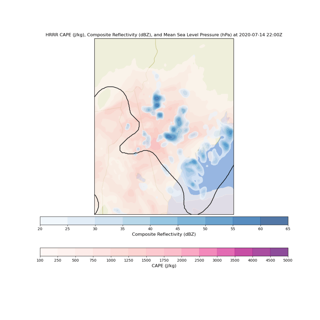
Today will feature another round of showers and thunderstorms as yet another upper-level disturbance pivots through the region.
Skies this morning range from partly cloudy across parts of Maine and far southern NH to overcast with heavy thunderstorms over parts of central NH. The storms in NH this morning are quite impressive and pose a serious flash flooding threat especially just west and southwest of Conway.
Satellite imagery is quite impressive for the early-morning hours here in New England. We don’t often get enough instability so early in the day to support such strong thunderstorms. I suspect we’ll see these particular storms begin to weaken a bit over the next couple hours while the atmosphere “recharges” in preparation for another round of storms to develop during the late morning hours.
By 1 PM, storms will be widespread across inland parts of the area and will even begin to develop along the sea breeze boundary near the coastline. Storms this afternoon will be capable of producing strong winds, heavy rain, and frequent lightning. A few small hailstones can’t be totally ruled out either.
By 6 PM, we still won’t have exhausted all the energy available in the atmosphere to support storms, at least according to current forecasts (I have some doubts given the southeastward advance of a low cloud deck from Downeast Maine this morning, but we’ll see if that can burn off). Some parts of the foothills will see two or three rounds of thunderstorm activity today. Those spots that do get hit repeatedly will have to worry about flash flooding given the amount of moisture we have to work with today.
Showers and storms will eventually subside around sunset.
Widespread cloud cover and repeated rounds of thunderstorm activity will keep high temps in check today. The mountains might not even crack 70 while most of the coastal plain and southern NH rise slowly into the mid/upper 70s. With dew points still stuck in the 60-65 range, it will still feel humid despite the cooler temps.
Today will feature yet another round of warm temperatures, high humidity, and afternoon showers/thunderstorms. Skies across the region this morning vary between mostly sunny in Maine (especially northeastern Maine) and mostly cloudy over New Hampshire (especially southern NH). From what I can tell, those clouds over NH are mostly present in the lower levels of the atmosphere so they should thin out and break up as the day goes on. More clouds will pop up this afternoon as instability builds.
By 2 PM, storms will be in progress across parts of NH and SW ME. As per usual, not everyone will see storms this afternoon, but if you live south of Route 2 and aren’t at the ends of the Midcoast peninsulas, the odds are strongly in favor of wet weather at some point this afternoon.
This afternoon’s storms will once again be lacking strong winds aloft to support widespread severe weather. That said, damaging winds will be a threat this afternoon, particularly over southern NH. Heavy rain will also cause some localized flash flooding issues as storms move fairly slowly.
Storms will continue through the first half of the night tonight as low pressure drifts northeast from the Mid Atlantic towards Cape Cod. After sunset, the primary threat from any remaining storms will be heavy rain.
High temps today will range from 75 in the north and right along the Midcoast shoreline to 85 in the usual warm spots of southern NH and interior ME.
Today will feature another day of warm and humid weather as well as another round of afternoon showers and thunderstorms. As I write this shortly after 8 AM, cloudy skies are being observed across the mountains and the coastline northeast of Portland. Meanwhile, a thin wedge of sunshine extends from southeastern NH into southwestern ME. With an upper-level low approaching from the west, I think this pattern will generally hold through the rest of the morning hours, though I think at least a few breaks of sun are possible up in the mountains and along parts of the Midcoast.
That sunshine will help push temps into the upper 80s to low 90s for southern NH and the foothills/coastal plain of Maine. Cooler temps (low/mid 80s) are expected in the mountains and along the Midcoast. Dew points will once again linger near 70 which will push heat index values towards 95 in southern NH and interior SW ME.
The combination of hot temperatures, high humidity, and an approaching upper-level low will prove favorable for thunderstorm activity this afternoon.
Model guidance shown here indicates that scattered showers and storms will pop up starting around 12-1 PM. As per usual, the mountains will be the first to see shower activity before storms move east towards the coastline. The biggest threat with this afternoon’s storms will be damaging winds in addition to heavy rain and lightning. Storms will fade after sunset.
As a quick aside, yesterday’s round of storms was admittedly much stronger than anticipated across the Sebago Lake region. While activity was expected to be focused in NH, a few strong cells strayed across the border. The strongest of these was a classic supercell that ended up producing an EF-0 tornado near Hiram. I happened to be out chasing that cell and got a neat timelapse showing the vigorous low-level rotation associated with that cell. The tornado itself is hard to spot in the video because it never produced a coherent “condensation funnel” connecting the circulation on the ground with the parent cloud.
The photo below was taken while the tornado was on the ground and shows a short condensation funnel dropping down from the cloud above as well as a plume of water being sucked upward from Barker Pond.
The plume of water is just to the right of the tallest pine tree above the yellow flowers. The condensation funnel is near the left edge of the ragged wall cloud extending from below the thunderstorm’s base. Both features are small and hard to spot, but are very rare to see here in Maine! Usually we get 1-2 tornadoes each year, but often they occur in remote northern parts of the state where only the observers are moose.
I’m quite confident we won’t see any tornadoes today, but then again, that’s what I said yesterday. We still have a lot to learn about tornadoes and how/when they form!
Today will feature continued muggy conditions and unsettled weather as the remnants of Tropical Storm Fay move from the upper Hudson Valley up into Canada. We’re currently dealing with scattered shower activity as a result of Fay, especially over parts of northern NH. Expect these showers to taper off over the coming hours as Fay moves north. Elsewhere across the region, low clouds currently in place will fade to partial sunshine over the next few hours.
By noon, most of the region should be at least partly sunny. As a result, temps will climb into the mid/upper 80s across most of southern NH and interior SW ME. Points farther northeast will take longer to clear out, and as a result will remain cooler (mid/upper 70s). The immediate coastline will also remain cooler as a result of onshore flow (mid/upper 70s). Unfortunately, dew points will remain near or above 70 across nearly the entire area.
Any time we have such high temperatures and humidity, we have to start thinking about thunderstorms. A cold front drifting into the region from the west will provide the “trigger” for storms to develop over NY this afternoon. These storms will then move east during the late afternoon/early evening hours. Unfortunately, the front is a little too late to maximize severe weather potential in our area, but a few storms in NH could produce gusty winds in addition to heavy rain.
A stray shower or storm can’t be ruled out in Maine this afternoon/evening, but any cells that pop up east of the border will be much less widespread, and will generally pose less of a severe weather threat.
We were spared from the worst heat and humidity yesterday as winds that were forecast to be from the SSW ended up shifting to the SSE which allowed for a stronger marine influence on our temperatures especially near the coastline.
A similar pattern will develop today as Tropical Storm Fay moves north along the Mid Atlantic coastline and we enter the far northeastern portion of its circulation. The heaviest rain associated with Fay will remain to our west as the system tracks up the Hudson Valley, but we’ll see clouds and showers from the system move through tonight.
Before any rain from Fay arrives, we’ll be working on slowly burning off a thick fog bank across most of the coastal plain and foothills this morning. Fog in this area is quite dense in spots (I estimated 1/8-1/4 mile visibility here in Yarmouth around 7:45) but will slowly thin out over the next few hours. The first to see sunshine will be those farther northwest and perhaps right along the York County coastline.
As low clouds retreat this morning, upper-level clouds will be advancing as Fay moves north. By this afternoon, we’ll return to overcast skies as the cirrus deck ahead of Fay thickens.
As far as precipitation goes today, a few showers and possibly a thunderstorm or two will pop up over NH or far NW ME around midday. None of these will be severe, but they could bring a brief period of heavy rain. Showers from Fay will arrive in southern NH after sunset.
High temps will range from 75 along the Midcoast and up in the mountains to near 90 in Central NH.
Unfortunately, yesterday’s storms (spectacular as they were) did not signal the approach of cooler and drier air. Instead, they marked the leading edge of an even warmer and more humid airmass working its way up the East Coast. We’ll get into that airmass today as winds remain stuck out of the south-southeast.
Satellite imagery this morning shows patchy low clouds and fog slowly burning off across the area. Expect mostly sunny skies to take over in the next couple hours as the fog finishes evaporating. That sunshine will push temps into the upper 80s in the north and low 90s for most of the rest of the area (cooler temps, in the mid/upper 80s, are expected right along the coast). This heat, combined with dew points in excess of 70, will produce dangerous heat index values of 95-100F by this afternoon across southern NH and adjacent parts of inland SW ME. With that in mind, today would be a good day to limit strenuous activity during the heat of the day.
With such hot and humid air, we’ll have to think about some showers and storms popping up in the mountains this afternoon but without much in the way of a forcing mechanism to trigger storm development, I’m not expecting activity to be very widespread.